Category:2009 maps of Asia
Jump to navigation
Jump to search
Temperate regions: North America · South America · Africa · Europe · Asia · Oceania – Polar regions: – Other regions:
English: 2009 maps of Asia
Español: Mapas de Asia en 2009
Subcategories
This category has the following 8 subcategories, out of 8 total.
A
- 2009 maps of Afghanistan (5 F)
I
- 2009 maps of India (21 F)
- 2009 maps of Indonesia (2 F)
- 2009 maps of Iran (4 F)
P
- 2009 maps of Pakistan (11 F)
R
- 2009 maps of Russia (6 F)
T
Media in category "2009 maps of Asia"
The following 11 files are in this category, out of 11 total.
-
 2009 Golan Heights 3D (30849226396).jpg 3,400 × 4,200; 4.58 MB
-
 ARMA 2 Chernarus factbook map.png 620 × 515; 188 KB
-
 Death-rate-from-opioid-use-who,Asia,2009.svg 850 × 600; 146 KB
-
 Death-rate-smoking,Asia,2009.svg 850 × 699; 146 KB
-
 Indonesian Province HDI 2009.svg 1,322 × 500; 392 KB
-
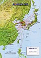 Korean Air 2009 - East Asia.jpg 786 × 1,125; 206 KB
-
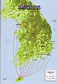 Korean Air 2009 - South Korea.jpg 783 × 1,123; 157 KB
-
 Nantou magistrate election 2009.png 526 × 791; 22 KB
-
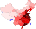 PRC Population Density.svg 857 × 699; 150 KB
-
 The Caucasus and Central Asia. LOC 2009584329.jpg 4,365 × 3,395; 1.74 MB
-
 The Caucasus and Central Asia. LOC 2009584329.tif 4,365 × 3,395; 42.4 MB
.jpg)


