Category:2009 UK local elections
Jump to navigation
Jump to search
British elections | |||||
| Upload media | |||||
| Instance of |
| ||||
|---|---|---|---|---|---|
| Location |
| ||||
| Point in time |
| ||||
| Follows | |||||
| Followed by | |||||
| |||||
Subcategories
This category has only the following subcategory.
B
Media in category "2009 UK local elections"
The following 42 files are in this category, out of 42 total.
-
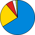
2009 Nottinghamshire County Council election composition.svg 360 × 185; 4 KB
-
Buckinghamshire wards 2009.svg 1,070 × 1,266; 1.33 MB
-
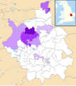
Cambridgeshire UK local election 2009 Con strength.svg 1,125 × 1,266; 1.35 MB
-
Cambridgeshire UK local election 2009 Green strength.svg 1,125 × 1,266; 1.35 MB
-
Cambridgeshire UK local election 2009 Lab strength.svg 1,125 × 1,266; 1.35 MB
-
Cambridgeshire UK local election 2009 LD strength.svg 1,125 × 1,266; 1.35 MB
-
Cambridgeshire UK local election 2009 map.svg 1,125 × 1,266; 1.35 MB
-
Cambridgeshire UK local election 2009 UKIP strength.svg 1,125 × 1,266; 1.35 MB
-
Composition of the Isle of Wight Council after the 2009 election.jpg 625 × 552; 45 KB
-
Cornwall UK local election 2009 map.svg 1,224 × 1,187; 2.06 MB
-
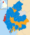
Cumbria wards 2009.svg 1,140 × 1,345; 2.05 MB
-
Derbyshire UK local election 2009 map.svg 884 × 1,305; 1.49 MB
-
Devon County Council election 2009 map.svg 1,292 × 1,187; 2.07 MB
-
Devon County Council political composition in 2009.svg 606 × 605; 5 KB
-
Dorset County Council political composition in 2009.png 269 × 269; 15 KB
-
Dorset UK local election 2009 map.svg 1,425 × 990; 1.39 MB
-
East Sussex wards 2009.svg 1,425 × 928; 1.19 MB
-
Essex UK local election 2009 map update.svg 1,428 × 1,144; 2.07 MB
-
Essex UK local election 2009 map.svg 1,428 × 1,144; 2.07 MB
-
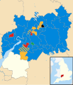
Gloucestershire UK local election 2009 map.svg 1,089 × 1,266; 1.62 MB
-
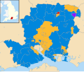
Hampshire wards 2009.svg 1,425 × 1,213; 1.77 MB
-
Hertfordshire wards 2009.svg 1,425 × 992; 1.18 MB
-
Isle of Wight wards 2009.svg 1,425 × 868; 881 KB
-
Kent UK local election 2009 map.svg 1,425 × 1,000; 1.66 MB
-
Lancashire wards 2009.svg 1,116 × 1,305; 1.78 MB
-
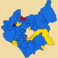
LCC 2009 Election Map.png 597 × 590; 83 KB
-
Lincolnshire UK local election 2009 map.svg 1,086 × 1,305; 1.87 MB
-
Map of the results of the United Kingdom local elections 2009.png 2,400 × 2,700; 228 KB
-
Norfolk County Council election 2009 map.svg 1,425 × 886; 1.41 MB
-
North Yorkshire wards 2009.svg 1,425 × 1,037; 1.97 MB
-
Northamptonshire UK local election 2009 map.svg 1,106 × 1,266; 1.52 MB
-
Nottinghamshire election 2009.svg 736 × 1,277; 651 KB
-
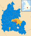
Oxfordshire wards 2009.svg 1,077 × 1,266; 1.51 MB
-
Somerset wards 2009.svg 1,425 × 901; 1.69 MB
-
Staffordshire wards 2009.svg 1,024 × 1,305; 1.5 MB
-
Suffolk UK local election 2009 map.svg 1,425 × 927; 1.49 MB
-
Surrey County Council 2009 election map.svg 1,425 × 1,081; 2.12 MB
-
Warwickshire UK local election 2009 map.svg 1,042 × 1,266; 1.33 MB
-
Warwickshire wards 2009.svg 1,042 × 1,266; 1.33 MB
-
West Sussex wards 2009.svg 1,425 × 995; 1.37 MB
-
Wiltshire UK local election 2009 map.svg 1,039 × 1,266; 1.64 MB
-
Worcestershire wards 2009.svg 1,425 × 1,262; 1.34 MB


