Category:2008 maps of York County, Pennsylvania
Jump to navigation
Jump to search
Counties of Pennsylvania : Adams · Allegheny · Crawford · Fayette · Lebanon · Luzerne · Philadelphia · York
| 2000s maps of York County, Pennsylvania: | 2006 2008 → |
Media in category "2008 maps of York County, Pennsylvania"
The following 29 files are in this category, out of 29 total.
-
 Map of York County, Pennsylvania Highlighting Carroll Township.PNG 800 × 550; 97 KB
-

-
 Map of York County, Pennsylvania Highlighting Codorus Township.PNG 800 × 550; 97 KB
-
 Map of York County, Pennsylvania Highlighting Conewago Township.PNG 800 × 550; 97 KB
-
 Map of York County, Pennsylvania Highlighting Dover Township.PNG 800 × 550; 97 KB
-

-

-
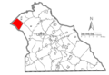
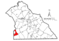
 Map of York County, Pennsylvania Highlighting Fairview Township.PNG 800 × 550; 97 KB
-
 Map of York County, Pennsylvania Highlighting Franklin Township.PNG 800 × 550; 97 KB
-
 Map of York County, Pennsylvania Highlighting Manheim Township.PNG 800 × 550; 97 KB
-
 Map of York County, Pennsylvania Highlighting Monaghan Township.PNG 800 × 550; 97 KB
-
 Map of York County, Pennsylvania Highlighting Newberry Township.PNG 800 × 550; 97 KB
-
-

-
 Map of York County, Pennsylvania Highlighting Paradise Township.PNG 800 × 550; 97 KB
-

-
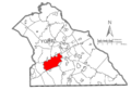
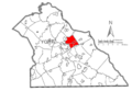
 Map of York County, Pennsylvania Highlighting Penn Township.PNG 800 × 550; 97 KB
-

-

-
-

-
 U.S. Census Bureau map of Hallam, Pennsylvania.gif 575 × 425; 36 KB
-

-

-

-

-
 Map of York County, Pennsylvania Highlighting Windsor Township.PNG 800 × 550; 97 KB
-
 Map of York County, Pennsylvania Highlighting York Township.PNG 800 × 550; 97 KB
-
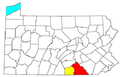 York-Hanover-Gettysburg CSA.png 565 × 361; 28 KB


