Category:2008 in County Donegal
Jump to navigation
Jump to search
Counties of the Republic of Ireland: Carlow · Cavan · Clare · Cork(1) · Donegal · Fingal(2) · Galway(3) · Kerry · Kildare · Kilkenny · Laois · Leitrim · Longford · Louth · Mayo · Meath · Monaghan · Offaly · Roscommon · Sligo · Tipperary(4) · Waterford · Westmeath · Wexford · Wicklow – Separate cities: Cork(1) · Dublin(2) · – Former counties: Dublin(2) · Former counties of Northern Ireland: Antrim · Armagh · Down · Fermanagh · Londonderry · Tyrone
Media in category "2008 in County Donegal"
The following 101 files are in this category, out of 101 total.
-
 Ardnaglass Townland - geograph.org.uk - 689280.jpg 640 × 479; 70 KB
-
 Assarnacally Waterfall - geograph.org.uk - 1157290.jpg 425 × 640; 329 KB
-
 Assarnacally Waterfall - Top portion - geograph.org.uk - 1157299.jpg 426 × 640; 296 KB
-
 Back Strand - geograph.org.uk - 884936.jpg 640 × 470; 97 KB
-
 Baile an tSratha, Ballintra - geograph.org.uk - 913410.jpg 640 × 416; 58 KB
-
 Ballynahone Townland - geograph.org.uk - 968913.jpg 640 × 479; 70 KB
-
 Ballynahone Townland - geograph.org.uk - 968915.jpg 640 × 479; 59 KB
-
 Ballynahone Townland - geograph.org.uk - 968946.jpg 640 × 479; 60 KB
-
 Ballynahone Townland - geograph.org.uk - 968947.jpg 640 × 479; 52 KB
-
 Ballynahone Townland - geograph.org.uk - 968959.jpg 640 × 479; 61 KB
-
 Ballynahone Townland - geograph.org.uk - 968960.jpg 640 × 479; 53 KB
-
 Ballynahone Townland - geograph.org.uk - 968961.jpg 640 × 479; 68 KB
-
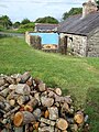
 Barn at Carrick West - geograph.org.uk - 910997.jpg 480 × 640; 110 KB
-
 Beach at Murvagh Lower - geograph.org.uk - 932551.jpg 480 × 640; 78 KB
-
 Bluestacks from Clanboorhin - geograph.org.uk - 888839.jpg 640 × 480; 78 KB
-
 Burnside Townland - geograph.org.uk - 1007216.jpg 640 × 479; 55 KB
-
 Burnside Townland - geograph.org.uk - 1007220.jpg 640 × 479; 68 KB
-
 Burnside Townland - geograph.org.uk - 998526.jpg 640 × 479; 70 KB
-
-
 Carnowen Townland - geograph.org.uk - 993337.jpg 640 × 479; 66 KB
-
 Carrick West - geograph.org.uk - 909618.jpg 640 × 480; 111 KB
-
 Carrowmore South Cross 2008.jpg 1,840 × 1,232; 658 KB
-
 Cashelard RC Church - geograph.org.uk - 884359.jpg 640 × 479; 64 KB
-
 Cashelard Townland - geograph.org.uk - 884379.jpg 640 × 479; 71 KB
-
 Cashelard Townland - geograph.org.uk - 884725.jpg 640 × 479; 69 KB
-
 Cashelard Townland - geograph.org.uk - 884733.jpg 640 × 479; 48 KB
-
 Cillin on Raneeny Hill - geograph.org.uk - 915731.jpg 640 × 480; 87 KB
-
 Clonca Old Church 2008.jpg 1,840 × 993; 599 KB
-
 Cloncha cross church.jpg 1,840 × 1,232; 567 KB
-
 Cooley Cross.jpg 1,840 × 1,232; 633 KB
-
 Cooly Early Ecclesiastical Site 2008.jpg 1,840 × 1,232; 709 KB
-
 Cooly Early Ecclesiastical Site plaque.jpg 1,840 × 1,232; 706 KB
-
 Derelict Cottage, Scadaman, Ardara - geograph.org.uk - 1113758.jpg 640 × 452; 131 KB
-
 Donagh Cross.jpg 1,840 × 1,232; 616 KB
-
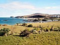
 Donegal Bay from Drumcliff Hill area - geograph.org.uk - 1092772.jpg 640 × 427; 74 KB
-
 Gate Lodge near Marble Hill Strand - geograph.org.uk - 774532.jpg 640 × 480; 472 KB
-
 Gate to Meadow, Tullywee - geograph.org.uk - 911005.jpg 640 × 480; 105 KB
-
 Glenveagh National Park - Lough Beagh - geograph.org.uk - 1188666.jpg 640 × 426; 136 KB
-
 Glenveagh National Park - Lough Beagh - geograph.org.uk - 1188698.jpg 640 × 426; 311 KB
-
 Glenveagh National Park - Lough Beagh - geograph.org.uk - 1188714.jpg 640 × 426; 239 KB
-

-

-

-

-

-
 Greencastle 01.jpg 1,840 × 1,232; 650 KB
-
 Greencastle 02.jpg 1,840 × 1,232; 599 KB
-
 Greencastle Castle, County Donegal 2008.jpg 1,809 × 1,186; 471 KB
-
 Grianan of Aileach 2008 (1).jpg 1,840 × 1,232; 683 KB
-
 Grianan of Aileach 2008 (2).jpg 1,792 × 1,161; 557 KB
-
 Heron in Drumrooske - geograph.org.uk - 1071639.jpg 640 × 521; 113 KB
-
 Holiday cottages - geograph.org.uk - 773037.jpg 640 × 360; 59 KB
-
 House in Trees - geograph.org.uk - 961869.jpg 427 × 640; 126 KB
-
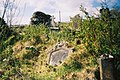
 Iskaheen old graveyard.jpg 1,840 × 1,232; 637 KB
-
 Iskaheen plaque.jpg 839 × 479; 60 KB
-
 Lane, Newtowndrumgoran - geograph.org.uk - 888815.jpg 640 × 480; 124 KB
-
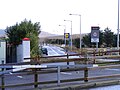 Lidl Supermarket - geograph.org.uk - 1030744.jpg 640 × 480; 72 KB
-
 Loch Gleann Bheatha (Lough Beagh) - geograph.org.uk - 899617.jpg 640 × 480; 205 KB
-
 Loch Gleann Bheatha (Lough Beagh) - geograph.org.uk - 899619.jpg 640 × 467; 204 KB
-
 Loch Gleann Bheatha (Lough Beagh) - geograph.org.uk - 899629.jpg 640 × 480; 249 KB
-
 Loch Gleann Bheatha (Lough Beagh) - geograph.org.uk - 899636.jpg 640 × 480; 248 KB
-
 Milltown Townland - geograph.org.uk - 993332.jpg 640 × 479; 68 KB
-
 Moville 2008.jpg 1,840 × 1,232; 1.5 MB
-
 Moville old graveyard.jpg 1,840 × 1,232; 899 KB
-
 Near the shore at Malin - geograph.org.uk - 813078.jpg 640 × 480; 98 KB
-
 Newtowndrumgoran townland - geograph.org.uk - 888797.jpg 640 × 480; 89 KB
-
 North West Golf Club (2) - geograph.org.uk - 746502.jpg 640 × 562; 102 KB
-
 Old farm at Tullywee - geograph.org.uk - 910999.jpg 640 × 480; 123 KB
-
 Old Railway, Killymard Halt - geograph.org.uk - 916276.jpg 640 × 480; 77 KB
-
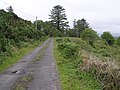
 Old Road to Trumman - geograph.org.uk - 910995.jpg 640 × 481; 84 KB
-
 Polestar at Port Bridge - geograph.org.uk - 910693.jpg 640 × 480; 56 KB
-
 Port na Blagh harbour - geograph.org.uk - 773415.jpg 640 × 565; 523 KB
-
-
 Railway Bridge at Foyagh - geograph.org.uk - 913411.jpg 640 × 480; 146 KB
-
 Railway Bridge at Rathneeny - geograph.org.uk - 915684.jpg 480 × 640; 133 KB
-

-
 Road at Ballynahone - geograph.org.uk - 968905.jpg 640 × 479; 55 KB
-
 Road at Ballynahone - geograph.org.uk - 968909.jpg 640 × 479; 46 KB
-
 Road at Ballynahone - geograph.org.uk - 968956.jpg 640 × 479; 47 KB
-
 Road at Beltany - geograph.org.uk - 993335.jpg 640 × 479; 82 KB
-
 Road at Cashelard - geograph.org.uk - 884364.jpg 640 × 479; 43 KB
-
 Road at Cashelard - geograph.org.uk - 884399.jpg 640 × 479; 74 KB
-
 Road at Cashelard - geograph.org.uk - 884446.jpg 640 × 479; 72 KB
-
 Road at Derrykillew - geograph.org.uk - 884739.jpg 640 × 479; 55 KB
-
 Road at Derrykillew - geograph.org.uk - 884761.jpg 640 × 479; 63 KB
-
 Road at Derrykillew - geograph.org.uk - 884766.jpg 640 × 479; 70 KB
-
 Road at Umley - geograph.org.uk - 953521.jpg 640 × 479; 53 KB
-
 Road near Meenreagh - geograph.org.uk - 723502.jpg 640 × 479; 66 KB
-
 Road near Tieveclogher - geograph.org.uk - 723480.jpg 640 × 479; 64 KB
-
 Ruin near Drumcliff Hill - geograph.org.uk - 1092753.jpg 427 × 640; 123 KB
-
 St Conall's National School 1987 - geograph.org.uk - 1032596.jpg 640 × 480; 126 KB
-
 SuperValu Supermarket - geograph.org.uk - 1030742.jpg 640 × 480; 68 KB
-

-
 Tawnydorragh Townland - geograph.org.uk - 663634.jpg 640 × 479; 63 KB
-
 The Independent Hostel at Doonan - geograph.org.uk - 920784.jpg 640 × 480; 87 KB
-
 Tullyard Townland - geograph.org.uk - 689166.jpg 640 × 479; 73 KB
-
 Tullywee field - geograph.org.uk - 909484.jpg 480 × 640; 107 KB
-
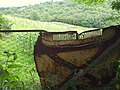
 Unusual entrance to unusual house - geograph.org.uk - 689284.jpg 640 × 281; 33 KB
-
 Unusual house at Ardnaglass - geograph.org.uk - 689289.jpg 479 × 640; 103 KB
-
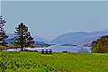
 View across lough - geograph.org.uk - 773047.jpg 640 × 480; 86 KB
-
 Well at Meenreagh - geograph.org.uk - 723544.jpg 640 × 479; 70 KB


.jpg)
.jpg)


_-_geograph.org.uk_-_899617.jpg)
_-_geograph.org.uk_-_899619.jpg)
_-_geograph.org.uk_-_899629.jpg)
_-_geograph.org.uk_-_899636.jpg)


_-_geograph.org.uk_-_746502.jpg)


