Category:2007 maps of the United Kingdom
Jump to navigation
Jump to search
Media in category "2007 maps of the United Kingdom"
The following 9 files are in this category, out of 9 total.
-
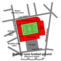
Bramall Lane football ground - plan.png 600 × 600; 31 KB
-
Canterbury UK local election 2007 map.svg 1,076 × 1,266; 458 KB
-
Hallamshire maximum extent.png 800 × 558; 381 KB
-
IsleOfMan SheadingsAndParishes-en.svg 1,200 × 1,100; 222 KB
-
Ppat.1000050.g001.tif 2,491 × 2,970; 1.01 MB
-
Sheffield outline map with UK.svg 612 × 437; 808 KB
-
Sheffield Parkway - plan.png 750 × 350; 19 KB
-
Sheffield UK local election 2007 map.svg 1,425 × 996; 641 KB
-
Southampton 2007 election map.png 564 × 480; 47 KB


