Category:2007 maps of Allegheny County, Pennsylvania
Jump to navigation
Jump to search
Media in category "2007 maps of Allegheny County, Pennsylvania"
The following 89 files are in this category, out of 89 total.
-
 Map of Allegheny County PA Highlighting WestHomestead.png 600 × 600; 29 KB
-
 Map of Allegheny County PA Highlighting WestMifflin.png 600 × 600; 29 KB
-
 Map of Allegheny County PA Highlighting Whitaker.png 600 × 600; 29 KB
-
 Map of Allegheny County PA Highlighting Whitehall.png 600 × 600; 29 KB
-
 Map of Allegheny County PA Highlighting WhiteOak.png 600 × 600; 29 KB
-
 Map of Allegheny County PA Highlighting Wilkins.png 600 × 600; 29 KB
-
 Map of Allegheny County PA Highlighting Wilkinsburg.png 600 × 600; 29 KB
-
 Map of Allegheny County PA Highlighting Wilmerding.png 600 × 600; 29 KB
-
 Map of Allegheny County PA Highlighting Aleppo.png 600 × 600; 29 KB
-
 Map of Allegheny County PA Highlighting Aspinwall.png 600 × 600; 29 KB
-
 Map of Allegheny County PA Highlighting Avalon.png 600 × 600; 29 KB
-
 Map of Allegheny County PA Highlighting BaldwinBorough.png 600 × 600; 29 KB
-
 Map of Allegheny County PA Highlighting BaldwinTownship.png 600 × 600; 29 KB
-
 Map of Allegheny County PA Highlighting BellAcres.png 600 × 600; 29 KB
-
 Map of Allegheny County PA Highlighting Bellevue.png 600 × 600; 29 KB
-
 Map of Allegheny County PA Highlighting BenAvon.png 600 × 600; 29 KB
-
 Map of Allegheny County PA Highlighting BenAvonHeights.png 600 × 600; 29 KB
-
 Map of Allegheny County PA Highlighting BethelPark.png 600 × 600; 29 KB
-
 Map of Allegheny County PA Highlighting Blawnox.png 600 × 600; 29 KB
-
 Map of Allegheny County PA Highlighting Brackenridge.png 600 × 600; 29 KB
-
 Map of Allegheny County PA Highlighting Braddock.png 600 × 600; 29 KB
-
 Map of Allegheny County PA Highlighting BraddockHills.png 600 × 600; 29 KB
-
 Map of Allegheny County PA Highlighting BradfordWoods.png 600 × 600; 29 KB
-
 Map of Allegheny County PA Highlighting Brentwood.png 600 × 600; 29 KB
-
 Map of Allegheny County PA Highlighting Bridgeville.png 600 × 600; 29 KB
-
 Map of Allegheny County PA Highlighting Carnegie.png 600 × 600; 29 KB
-
 Map of Allegheny County PA Highlighting CastleShannon.png 600 × 600; 29 KB
-
 Map of Allegheny County PA Highlighting Chalfant.png 600 × 600; 29 KB
-
 Map of Allegheny County PA Highlighting Cheswick.png 600 × 600; 29 KB
-
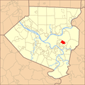 Map of Allegheny County PA Highlighting Churchill.png 600 × 600; 29 KB
-
 Map of Allegheny County PA Highlighting Clairton.png 600 × 600; 29 KB
-
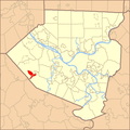
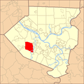 Map of Allegheny County PA Highlighting Collier.png 600 × 600; 29 KB
-
 Map of Allegheny County PA Highlighting Coraopolis.png 600 × 600; 29 KB
-
 Map of Allegheny County PA Highlighting Crafton.png 600 × 600; 29 KB
-
 Map of Allegheny County PA Highlighting Crescent.png 600 × 600; 29 KB
-
 Map of Allegheny County PA Highlighting Curtisville.png 600 × 600; 29 KB
-
 Map of Allegheny County PA Highlighting Dormont.png 600 × 600; 29 KB
-
 Map of Allegheny County PA Highlighting Dravosburg.png 600 × 600; 29 KB
-
 Map of Allegheny County PA Highlighting Duquesne.png 600 × 600; 29 KB
-
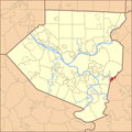
 Map of Allegheny County PA Highlighting EastDeer.png 600 × 600; 29 KB
-
 Map of Allegheny County PA Highlighting EastMcKeesport.png 600 × 600; 29 KB
-
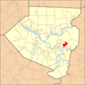
 Map of Allegheny County PA Highlighting EastPittsburgh.png 600 × 600; 29 KB
-
 Map of Allegheny County PA Highlighting Heidelberg.png 600 × 600; 29 KB
-
 Map of Allegheny County PA Highlighting Homestead.png 600 × 600; 29 KB
-
 Map of Allegheny County PA Highlighting ImperialEnlow.png 600 × 600; 29 KB
-
 Map of Allegheny County PA Highlighting Indiana.png 600 × 600; 29 KB
-
 Map of Allegheny County PA Highlighting Ingram.png 600 × 600; 29 KB
-
 Map of Allegheny County PA Highlighting JeffersonHills.png 600 × 600; 29 KB
-
 Map of Allegheny County PA Highlighting Kennedy.png 600 × 600; 29 KB
-
 Map of Allegheny County PA Highlighting Kilbuck.png 600 × 600; 29 KB
-
 Map of Allegheny County PA Highlighting Leet.png 600 × 600; 29 KB
-
 Map of Allegheny County PA Highlighting Leetsdale.png 600 × 600; 29 KB
-
 Map of Allegheny County PA Highlighting Liberty.png 600 × 600; 29 KB
-
 Map of Allegheny County PA Highlighting Lincoln.png 600 × 600; 29 KB
-
 Map of Allegheny County PA Highlighting Oakdale.png 600 × 600; 29 KB
-
 Map of Allegheny County PA Highlighting Oakmont.png 600 × 600; 29 KB
-
 Map of Allegheny County PA Highlighting OHara.png 600 × 600; 29 KB
-
 Map of Allegheny County PA Highlighting Ohio.png 600 × 600; 29 KB
-
 Map of Allegheny County PA Highlighting Osborne.png 600 × 600; 29 KB
-
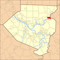
 Map of Allegheny County PA Highlighting PennHills.png 600 × 600; 29 KB
-
 Map of Allegheny County PA Highlighting PennsburyVillage.png 600 × 600; 29 KB
-
 Map of Allegheny County PA Highlighting Pine.png 600 × 600; 29 KB
-
 Map of Allegheny County PA Highlighting Pitcairn.png 600 × 600; 29 KB
-
 Map of Allegheny County PA Highlighting Marshall.png 600 × 600; 29 KB
-
 Map of Allegheny County PA Highlighting McCandless.png 600 × 600; 29 KB
-
 Map of Allegheny County PA Highlighting McDonald.png 600 × 600; 29 KB
-
 Map of Allegheny County PA Highlighting McKeesRocks.png 600 × 600; 29 KB
-
 Map of Allegheny County PA Highlighting McKeesport.png 600 × 600; 29 KB
-
 Map of Allegheny County PA Highlighting Millvale.png 600 × 600; 29 KB
-
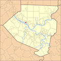
 Map of Allegheny County PA Highlighting CarnotMoon.png 600 × 600; 29 KB
-
 Map of Allegheny County PA Highlighting Sharpsburg.png 600 × 600; 29 KB
-
 Map of Allegheny County PA Highlighting SouthFayette.png 600 × 600; 29 KB
-
 Map of Allegheny County PA Highlighting SouthPark.png 600 × 600; 29 KB
-
 Map of Allegheny County PA Highlighting SouthVersailles.png 600 × 600; 29 KB
-
 Map of Allegheny County PA Highlighting SpringdaleBorough.png 600 × 600; 29 KB
-
 Map of Allegheny County PA Highlighting SpringdaleTownship.png 600 × 600; 29 KB
-
 Map of Allegheny County PA Highlighting Stowe.png 600 × 600; 29 KB
-
 Map of Allegheny County PA Highlighting SturgeonNoblestown.png 600 × 600; 29 KB
-
 Map of Allegheny County PA Highlighting Swissvale.png 600 × 600; 29 KB
-
 Map of Allegheny County PA Highlighting Tarentum.png 600 × 600; 29 KB
-
 Map of Allegheny County PA Highlighting Thornburg.png 600 × 600; 29 KB
-
 Map of Allegheny County PA Highlighting Trafford.png 600 × 600; 29 KB
-
 Map of Allegheny County PA Highlighting TurtleCreek.png 600 × 600; 29 KB
-
 Map of Allegheny County PA Highlighting UpperStClair.png 600 × 600; 29 KB
-
 Map of Allegheny County PA Highlighting Verona.png 600 × 600; 29 KB
-
 Map of Allegheny County PA Highlighting Versailles.png 600 × 600; 29 KB
-
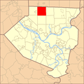
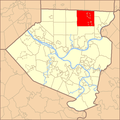 Map of Allegheny County PA Highlighting WestDeer.png 600 × 600; 29 KB
-
 Map of Allegheny County PA Highlighting WestElizabeth.png 600 × 600; 29 KB
-
 Map of Allegheny County PA Highlighting WestView.png 600 × 600; 29 KB


