Category:2006 maps of India
Jump to navigation
Jump to search
English: 2006 maps made in India or from India or showing history of India
Media in category "2006 maps of India"
The following 15 files are in this category, out of 15 total.
-
India roadway map-NORD.png 250 × 158; 37 KB
-
India UTTARPRADESH.svg 1,486 × 1,734; 441 KB
-
India-roma.png 527 × 599; 97 KB
-
India-state elections 2006.svg 1,486 × 1,734; 446 KB
-
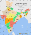
Indiastates&utnumbered 2.PNG 1,000 × 1,138; 135 KB
-
Indiastates&utnumbered fr.png 1,000 × 1,138; 165 KB
-
Indiastates&utnumbered.png 1,000 × 1,138; 175 KB
-
Indie 2006.png 1,389 × 1,813; 400 KB
-
National highway network map.png 1,000 × 1,138; 146 KB
-
Railway network map of India - Schematic.png 2,282 × 2,500; 928 KB
-
Railway network map of India - Schematic.svg 879 × 965; 865 KB
-
Railway network of India.png 1,000 × 1,138; 130 KB
-
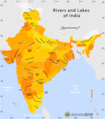
Rivers and lakes map.png 1,000 × 1,138; 91 KB
-
SITE-map-locations.svg 1,486 × 1,734; 450 KB
-
WikiProject AIDS Control Agencies in India.JPG 900 × 1,024; 94 KB


