Category:2001 maps of the United States
Jump to navigation
Jump to search
Subcategories
This category has the following 6 subcategories, out of 6 total.
Media in category "2001 maps of the United States"
The following 6 files are in this category, out of 6 total.
-
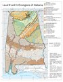 Alabama Level IV ecoregions.pdf 1,275 × 1,650; 604 KB
-
 Map of Compton, California (c. 2001).gif 400 × 274; 41 KB
-
 United States installed wind power capacity by state 2001.jpg 702 × 511; 220 KB
-
 United States. LOC 2002622296.jpg 2,096 × 2,757; 805 KB
-
 Utah Level IV ecoregions.pdf 7,200 × 5,400; 6.32 MB
-
 Vailoa Map.jpg 358 × 381; 30 KB
.gif)


