Category:2000s maps of Bremen (state)
Jump to navigation
Jump to search
Federal states of Germany:

Subcategories
This category has the following 4 subcategories, out of 4 total.
Media in category "2000s maps of Bremen (state)"
This category contains only the following file.
-
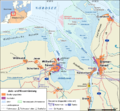
Jade-weser-muendung map de.png 800 × 743; 415 KB
