Category:19th century topographic maps of Yvelines
Jump to navigation
Jump to search
Media in category "19th century topographic maps of Yvelines"
The following 10 files are in this category, out of 10 total.
-
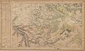 Carte d'État-major de la France, Feuille Chartres N.E.jpg 23,008 × 13,746; 91.89 MB
-
 Carte d'État-major de la France, Feuille Chartres S.E.jpg 23,008 × 13,641; 89.08 MB
-
 Carte d'État-major de la France, Feuille Melun N.O.jpg 23,008 × 13,710; 90.36 MB
-
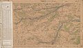 Carte d'État-major de la France, Feuille Melun S.O.jpg 23,480 × 13,614; 87.72 MB
-
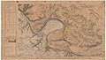
 Carte d'État-major de la France, Feuille Paris N.O.jpg 24,567 × 13,825; 116.21 MB
-
 Carte d'État-major de la France, Feuille Paris S.O.jpg 22,913 × 13,227; 101.16 MB
-
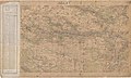
 Carte d'État-major de la France, Feuille Paris.jpg 30,000 × 9,600; 294.07 MB
-
 Carte d'État-major de la France, Feuille Évreux N.E.jpg 23,622 × 13,470; 111.16 MB
-
 Carte d'État-major de la France, Feuille Évreux S.E.jpg 23,740 × 13,914; 107.43 MB
-
 Carte d'État-major de la France, Feuille Évreux S.O.jpg 23,811 × 13,872; 105.65 MB


