Category:19th century topographic maps of Marne (department)
Jump to navigation
Jump to search
Media in category "19th century topographic maps of Marne (department)"
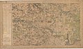
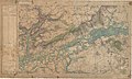
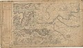
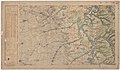
The following 30 files are in this category, out of 30 total.
-
 Carte d'État-major de la France, Feuille Arcis N.E.jpg 23,031 × 13,651; 319.18 MB
-
 Carte d'État-major de la France, Feuille Arcis N.O.jpg 23,031 × 13,482; 301.1 MB
-
 Carte d'État-major de la France, Feuille Arcis S.E.jpg 23,386 × 13,448; 312.78 MB
-
 Carte d'État-major de la France, Feuille Arcis S.O.jpg 23,031 × 13,427; 292.52 MB
-
 Carte d'État-major de la France, Feuille Bar-le-Duc N.E.jpg 23,150 × 13,731; 350.52 MB
-
 Carte d'État-major de la France, Feuille Bar-le-Duc N.O.jpg 23,622 × 13,645; 349.87 MB
-
 Carte d'État-major de la France, Feuille Bar-le-Duc S.E.jpg 23,622 × 13,727; 341.72 MB
-
 Carte d'État-major de la France, Feuille Bar-le-Duc S.O.jpg 23,622 × 13,809; 362.4 MB
-
 Carte d'État-major de la France, Feuille Châlons-sur-Marne N.E.jpg 23,386 × 13,641; 316.68 MB
-
 Carte d'État-major de la France, Feuille Châlons-sur-Marne N.O.jpg 23,386 × 13,750; 326.79 MB
-
 Carte d'État-major de la France, Feuille Châlons-sur-Marne S.E.jpg 23,386 × 13,670; 317.54 MB
-
 Carte d'État-major de la France, Feuille Châlons-sur-Marne S.O.jpg 23,386 × 13,817; 332.46 MB
-
 Carte d'État-major de la France, Feuille Meaux N.E.jpg 23,622 × 13,935; 108.61 MB
-
 Carte d'État-major de la France, Feuille Meaux S.E.jpg 23,811 × 13,952; 108.76 MB
-
 Carte d'État-major de la France, Feuille Provins N.E.jpg 23,031 × 13,645; 95.51 MB
-
 Carte d'État-major de la France, Feuille Provins S.E.jpg 22,559 × 13,563; 86.52 MB
-
 Carte d'État-major de la France, Feuille Reims N.E.jpg 23,268 × 13,562; 303.09 MB
-
 Carte d'État-major de la France, Feuille Reims N.O (brimont).jpg 5,582 × 4,786; 26.36 MB
-
 Carte d'État-major de la France, Feuille Reims N.O (cormicy).jpg 5,321 × 5,221; 29.11 MB
-
 Carte d'État-major de la France, Feuille Reims N.O (craonne).jpg 3,823 × 2,582; 10.82 MB
-
 Carte d'État-major de la France, Feuille Reims N.O.jpg 23,268 × 13,653; 311.97 MB
-
 Carte d'État-major de la France, Feuille Reims S.E.jpg 22,913 × 13,688; 321.38 MB
-
 Carte d'État-major de la France, Feuille Reims S.O.jpg 23,268 × 13,662; 323.59 MB
-
 Carte d'État-major de la France, Feuille Soissons N.E.jpg 23,362 × 13,787; 319.88 MB
-
 Carte d'État-major de la France, Feuille Soissons S.E.jpg 23,622 × 13,602; 322.23 MB
-
 Carte d'État-major de la France, Feuille Verdun S.E.jpg 23,622 × 13,686; 350.92 MB
-
 Carte d'État-major de la France, Feuille Verdun S.O.jpg 23,622 × 13,827; 355.51 MB
-
 Carte d'État-major de la France, Feuille Wassy N.E.jpg 23,622 × 13,834; 365.35 MB
-
 Carte d'État-major de la France, Feuille Wassy N.O.jpg 23,362 × 13,710; 330.63 MB
-
 Carte d'État-major de la France, Feuille Wassy S.O.jpg 23,362 × 13,732; 335.03 MB


.jpg)
.jpg)
.jpg)


