Category:19th century topographic maps of Manche
Jump to navigation
Jump to search
Media in category "19th century topographic maps of Manche"
The following 15 files are in this category, out of 15 total.
-

-

-
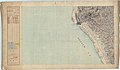
 Plan topographique et hydrographique... de Cherbourg... - btv1b53084971t.jpg 10,600 × 8,081; 12.49 MB
-
 Carte d'État-major de la France, Feuille Barneville N.E.jpg 24,331 × 14,168; 88.86 MB
-
 Carte d'État-major de la France, Feuille Barneville S.E.jpg 15,832 × 14,130; 46.3 MB
-
 Carte d'État-major de la France, Feuille Cherbourg N.O.jpg 24,496 × 14,212; 93.97 MB
-
 Carte d'État-major de la France, Feuille Cherbourg S.O.jpg 24,496 × 14,208; 117.62 MB
-
 Carte d'État-major de la France, Feuille Les Pieux N.E.jpg 23,859 × 14,246; 87.68 MB
-
 Carte d'État-major de la France, Feuille Les Pieux S.E.jpg 25,110 × 14,436; 105.55 MB
-
 Carte d'État-major de la France, Feuille Saint-Lô N.E.jpg 24,331 × 14,267; 96.34 MB
-
 Carte d'État-major de la France, Feuille Saint-Lô N.O.jpg 23,764 × 14,162; 116.62 MB
-
 Carte d'État-major de la France, Feuille Saint-Lô S.E.jpg 24,331 × 14,237; 119.2 MB
-
 Carte d'État-major de la France, Feuille Saint-Lô S.O.jpg 24,331 × 14,199; 119.77 MB
-
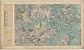
 Fermanville – Carte d'État-major de la France, Feuille Cherbourg N.O.png 4,688 × 3,763; 34.12 MB
-
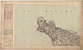
 Val de Saire – Carte d'État-major de la France, Feuilles Cherbourg et SO.png 11,252 × 8,815; 221.09 MB


