Category:19th-century maps of volcanoes in the Canary Islands
Jump to navigation
Jump to search
Media in category "19th-century maps of volcanoes in the Canary Islands"
The following 7 files are in this category, out of 7 total.
-
 31 of 'Rides and Studies in the Canary Islands ... Illustrated' (11291479636).jpg 1,296 × 1,070; 299 KB
-
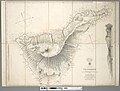 Admiralty Chart No 1870 Tenerife - Canary Islands, Surveyed 1838.jpg 8,197 × 6,225; 14.04 MB
-
 AFR V3 D084 Teyde Peak - Canary Islands.jpg 2,000 × 2,289; 1.11 MB
-
 AFR V3 D093 Recent Lavas of Lanzarote - Canary Islands.jpg 2,032 × 1,418; 593 KB
-
 AFR V3 D096 Cirque de Tejeda - Canary Islands.jpg 2,066 × 1,727; 819 KB
-
 AFR V3 D104 La Palma - Canary Islands.jpg 1,817 × 2,818; 1.23 MB
-
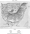
 AFR V3 D106 Hierro - Canary Islands.jpg 2,070 × 2,032; 945 KB
.jpg)


