
Category:19th-century maps of the world
Subcategories
This category has the following 16 subcategories, out of 16 total.
Media in category "19th-century maps of the world"
The following 20 files are in this category, out of 20 total.
-

-

-
 A Map of the World WDL6672.png 1,347 × 1,024; 2.22 MB
-
 AbsatzgebietHarkortBruecken.jpg 3,268 × 2,293; 2.05 MB
-
 Actual & supposed routes of Cholera from Hindoostan to Europe Wellcome L0041104.jpg 4,008 × 2,672; 2.54 MB
-
 Actual & supposed routes of Cholera from Hindoostan to Europe Wellcome L0074539.jpg 5,802 × 4,145; 6.63 MB
-
 Annales des sciences d'observation (1829) (17782794424).jpg 2,578 × 2,400; 789 KB
-
 Arthur and Fritz Kahn Collection 1889-1932 (20339844025).jpg 4,500 × 2,954; 1.74 MB
-
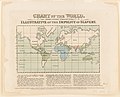
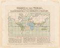
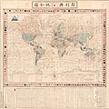
 Atlas of the World WDL2686.jpg 1,128 × 1,024; 300 KB
-
-
-
 FMIB 34726 Mean Track of the 'Cachalot' on a Whaling Cruise Round the World.jpeg 1,471 × 1,044; 427 KB
-

-
 Georgicorum libri quatuor (1827) (14597630678).jpg 3,248 × 1,640; 675 KB
-
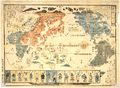
 Isochronic Passage Chart Francis Galton 1881.jpg 1,145 × 749; 335 KB
-

-
-
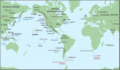 Maritime Fur Trade-WorldContext.png 1,378 × 805; 232 KB
-
 People of Many Nations WDL4353.png 1,389 × 1,024; 2.72 MB
-
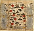
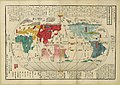
 Shinkan Yochi zenzu (14006160149).jpg 1,995 × 2,000; 1.61 MB


_(17782794424).jpg)
.jpg)


_showing_the_distribution_of_sea_surface_temperature_observations_since_1860.webp)
_(14597630678).jpg)

.jpg)
.jpg)


.jpg)
_by_Imakajiyamachi_Eijudo._Original_from_The_Beinecke_Rare_Book_%26_Manuscript_Library._Digitally_enhanced_by_rawpixel._(50623708202).jpg)
%27_(11031959826).jpg)