Category:19th-century maps of Western Australia
Jump to navigation
Jump to search
Subcategories
This category has only the following subcategory.
Media in category "19th-century maps of Western Australia"
The following 60 files are in this category, out of 60 total.
-
 (1842) MAP OF WESTERN AUSTRALIA.jpg 3,149 × 3,887; 2.23 MB
-
-

-
 251 of '(Articles on mining and geology reprinted from periodicals.)' (11212158843).jpg 2,208 × 1,424; 546 KB
-
 679 of '(Articles on mining and geology reprinted from periodicals.)' (11213627676).jpg 1,431 × 2,366; 922 KB
-

-

-
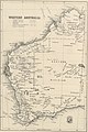
 W.-Australia(1892) p011 AGRICULTURAL DEVELOPMENT AREAS IN WESTERN AUSTRALIA.jpg 2,997 × 4,467; 5.11 MB
-
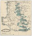 (1894) GREAT SOUTHERN RAILWAY OF WESTERN AUSTRALIA.jpg 2,779 × 3,093; 4.42 MB
-
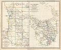
 (1894) WESTERN AUSTRALIA.jpg 2,175 × 3,237; 3.32 MB
-
-

-

-

-

-
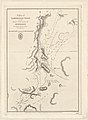
 A plan of Cambridge Gulf, on the north west coast of Australia, Published 1826.jpg 5,703 × 7,529; 9.6 MB
-
 A plan of Exmouth Gulf, on the north west coast of Australia, Published 1826.jpg 9,648 × 7,296; 17.99 MB
-

-

-
 Admiralty Chart No 1047 N.W. coast of Australia. Sheet V, Published 1825.jpg 11,686 × 7,974; 41.47 MB
-
 Admiralty Chart No 1048 N.W. coast of Australia Sheet VI, Published 1825.jpg 10,023 × 7,550; 34.59 MB
-
-

-
-

-
 Admiralty Chart No 1053 Dampier's Archipelago, Published 1826.jpg 4,893 × 3,915; 8.2 MB
-
-
 Admiralty Chart No 1055 N.W. and West Coasts of Australia. Sheet VII, Published 1825.jpg 10,009 × 7,418; 37.97 MB
-

-
 Admiralty Chart No 1056 West Coast of Australia. Sheet VIII, Published 1835.jpg 7,520 × 9,848; 53.58 MB
-

-

-
 Admiralty Chart No 1060 Chart of Terra Australis South coast, sheet II, Published 1814.jpg 11,723 × 7,898; 38.72 MB
-
 Admiralty Chart No 1266 Western Australia Peel Harbour and Warnbro Sound, Published 1840.jpg 7,706 × 5,813; 22.75 MB
-
 Admiralty Chart No 1388 Cambridge Gulf, Published 1891.jpg 11,220 × 18,719; 38.77 MB
-
 Admiralty Chart No 1437 Australia - North West coast Port Hedland, Published 1897.jpg 8,026 × 11,752; 48.88 MB
-
 Admiralty Chart No 1700 Western Australia Swan River and Rottnest Island, Published 1845.jpg 10,931 × 7,476; 36.09 MB
-

-

-

-
 Barrack Street jetty area, c.1900.png 2,067 × 1,417; 4.07 MB
-
 Burswood peninsula - being a part of the 1838 plan.jpg 836 × 1,302; 583 KB
-
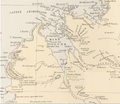
 Discoveries in Western Australia 1833 SLWA b1775631 1.png 5,776 × 4,806; 35.11 MB
-

-

-
 Discoveries in Western Australia 1833 SLWA b1775631 4.png 7,435 × 6,227; 56.98 MB
-
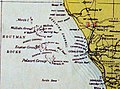 Houtman1897.JPG 2,029 × 1,501; 2.19 MB
-
 Kent County Western Australia (J Sands 1886).png 663 × 405; 513 KB
-
 Map of King Sound (Western Australia) in 1886.png 511 × 443; 291 KB
-
 Map of Perth (Western Australia) 1886.png 506 × 465; 309 KB
-
 Map of the Counties of West Australia (2).png 439 × 439; 349 KB
-
 Map of the Counties of West Australia 1886 (1).png 475 × 349; 339 KB
-
 Map of the Counties of Western Australia 1886 (3).png 476 × 320; 275 KB
-
 MRWA plan, 1894.jpg 497 × 760; 108 KB
-
 NW Australia 1885.jpg 1,263 × 1,396; 269 KB
-
 NW Coast 1897.JPG 3,484 × 1,748; 2.53 MB
-
 Part of Western Australia (Discoveries in Australia).jpg 986 × 953; 388 KB
-
 Perth County 1886.jpg 1,041 × 1,266; 329 KB
-
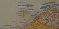
 South Coast — Cape Leeuwin, Cape Chatham and Eclipse Isles.jpg 594 × 424; 45 KB
-
 The second town plan of Perth, in 1838.jpg 480 × 283; 151 KB
_MAP_OF_WESTERN_AUSTRALIA.jpg)

%27_(11164135755).jpg)
%27_(11212158843).jpg)
%27_(11213627676).jpg)
%27_(11211541584).jpg)
%27_(16404429749).jpg)
_p011_AGRICULTURAL_DEVELOPMENT_AREAS_IN_WESTERN_AUSTRALIA.jpg)
_GREAT_SOUTHERN_RAILWAY_OF_WESTERN_AUSTRALIA.jpg)
_WESTERN_AUSTRALIA.jpg)
.jpg)
.jpg)

.jpg)
.jpg)


.png)
.png)


.png)
_in_1886.png)
_1886.png)
.png)
.png)
.png)


.jpg)


