Category:19th-century maps of Puy-de-Dôme
Jump to navigation
Jump to search
Media in category "19th-century maps of Puy-de-Dôme"
The following 9 files are in this category, out of 9 total.
-

-

-
 Carte du département du Puy-de-Dôme - 1841.jpg 5,639 × 3,847; 2.17 MB
-
 Carte du département du Puy-de-Dôme - 1847.jpg 11,351 × 7,722; 10.15 MB
-
 Carte géométrique et topographique du département du Puy-de-Dôme - 1845.jpg 9,925 × 7,225; 10.64 MB
-

-
 Dépt. du Puy de Dôme (région du centre) - Fonds Ancely - B315556101 A LEVASSEUR 066.jpg 3,080 × 2,080; 2.12 MB
-
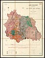 FR-631136102 CA 49.jpg 4,320 × 5,601; 4.07 MB
-
 Le Tour du monde - 13 (page 111 crop).jpg 1,932 × 2,836; 3.69 MB

%27_(11116282844).jpg)


_-_Fonds_Ancely_-_B315556101_A_LEVASSEUR_066.jpg)

.jpg)