Category:19th-century maps of Overijssel
Jump to navigation
Jump to search
Provinces of the Netherlands: Drenthe · Friesland · Gelderland · Groningen · North Brabant · North Holland · Overijssel · South Holland · Zeeland
Subcategories
This category has only the following subcategory.
Media in category "19th-century maps of Overijssel"
The following 9 files are in this category, out of 9 total.
-
 Hengelo omstreeks 1810.jpg 6,214 × 4,896; 4.64 MB
-

-
 Kadastrale kaart 1811-1832, minuutplan Dalfsen, Overijssel, sectie K, blad 05.jpg 12,042 × 7,870; 18.39 MB
-
 Kadastrale kaart 1811-1832, minuutplan Kamperveen, Overijssel, sectie E, blad 02.jpg 12,526 × 7,962; 15.46 MB
-
 Wittenstein op de kadastrale kaart 1811-1832, minuutplan Kamperveen, Overijssel.jpg 2,730 × 1,661; 707 KB
-
 Hasselo weerselo 1832.jpg 960 × 611; 166 KB
-
 Oelemars-1835.jpg 645 × 700; 112 KB
-
 Overijssel 1849.jpg 850 × 1,000; 1.08 MB
-
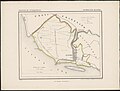 Provincie Overijssel gemeente Kuinre 1867.jpg 3,153 × 2,380; 1.93 MB


