Category:19th-century maps of Manchuria
Jump to navigation
Jump to search
Media in category "19th-century maps of Manchuria"
The following 9 files are in this category, out of 9 total.
-
Illustrated general route map of three countries (14590511136).jpg 2,500 × 1,764; 1.2 MB
-
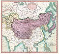
1806 Cary Map of Tartary or Central Asia - Geographicus - Tartary-cary-1806.jpg 5,000 × 4,569; 8.57 MB
-
John-Tallis-1851-Tibet-Mongolia-and-Manchuria-33621.jpg 4,030 × 3,102; 12.64 MB
-
Letts-Popular-Atlas-1883-Russia-in-Asia-Chinese-Empire-etc-Liaoning-thumbnail.jpg 1,400 × 1,000; 448 KB
-
411 of 'China in Transformation ... With ... maps and diagrams' (11247009075).jpg 4,916 × 4,369; 5.14 MB
-
59 of 'China in Transformation ... With ... maps and diagrams' (11247294074).jpg 1,423 × 1,541; 636 KB


