Category:19th-century maps of Doubs (department)
Jump to navigation
Jump to search
Media in category "19th-century maps of Doubs (department)"
The following 3 files are in this category, out of 3 total.
-
-
 Carte d'État-major de la France, Feuille Ferrette S.O.jpg 23,858 × 13,203; 61.32 MB
-
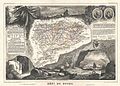
 Dépt. du Doubs (région de l'est) - Fonds Ancely - B315556101 A LEVASSEUR 028.jpg 3,104 × 2,048; 2.35 MB


_-_Fonds_Ancely_-_B315556101_A_LEVASSEUR_028.jpg)