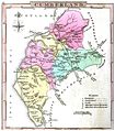
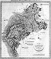
Category:19th-century maps of Cumberland
Jump to navigation
Jump to search
Ceremonial counties of England: Bedfordshire · Berkshire · Buckinghamshire · Cambridgeshire · Cheshire · Cornwall · Derbyshire · Devon · Dorset · Durham · Essex · Gloucestershire · Greater London · Hampshire · Herefordshire · Hertfordshire · Isle of Wight · Kent · Lancashire · Leicestershire · Lincolnshire · Norfolk · Northamptonshire · Northumberland · Nottinghamshire · Oxfordshire · Rutland · Shropshire · Somerset · Staffordshire · Suffolk · Surrey · Warwickshire · Wiltshire · Worcestershire
City-counties:
Former historic counties: Cumberland · Huntingdonshire · Middlesex · Sussex · Westmorland · Yorkshire
Other former counties:
City-counties:
Former historic counties: Cumberland · Huntingdonshire · Middlesex · Sussex · Westmorland · Yorkshire
Other former counties:
Subcategories
This category has only the following subcategory.
Media in category "19th-century maps of Cumberland"
The following 33 files are in this category, out of 33 total.
-
Aikin(1800) p051 - Cumberland.jpg 1,187 × 1,870; 431 KB
-
Cary's Traveller's companion 1806 (72194620).jpg 2,795 × 4,346; 2.08 MB
-
Print, book-illustration, map (BM 1871,0812.3259).jpg 2,500 × 1,456; 237 KB
-
A topographical dictionary of the United Kingdom (1808) (14784755602).jpg 3,072 × 1,736; 1.3 MB
-
Gray1824.cumberland.jpg 799 × 909; 119 KB
-
Gray1824.thelakes.jpg 825 × 957; 160 KB
-
William Smith geological map of Cumberland.jpg 1,070 × 1,232; 506 KB
-
The Quarterly journal of the Geological Society of London (12513043835).jpg 2,223 × 2,881; 1.63 MB
-
1836 Cumberland County Map Print A. Fullarton Carlisle.jpg 5,008 × 6,176; 11.25 MB
-
Pigot and Co (1842) p2.042 - Map of Cumberland.jpg 1,310 × 2,158; 806 KB
-
28 of 'An Essay on the Geology of Cumberland and Westmorland' (11243747454).jpg 1,335 × 1,327; 272 KB
-
The Quarterly journal of the Geological Society of London (12734130884).jpg 1,637 × 1,235; 419 KB
-
Railwayjunction00airegoog 0049b.tif 1,093 × 1,732; 835 KB
-
Railwayjunction00airegoog 0049c.jpg 1,093 × 1,732; 605 KB
-
308 of '(Our own country. Descriptive, historical, pictorial.)' (11286943994).jpg 1,100 × 1,110; 361 KB
-
449 of '(Our own country. Descriptive, historical, pictorial.)' (11296535116).jpg 1,678 × 1,155; 560 KB
-
228 of 'Home Geography of England and Wales ... With ... maps, etc' (11222298103).jpg 1,284 × 2,087; 714 KB
-
29 of 'The “Beaumont” Geography and Map Tracing Book' (11248025025).jpg 1,970 × 2,003; 683 KB
-
161 of 'Chambers's Alternative Geography Readers. Standard IV.(-VII.)' (11293494923).jpg 1,137 × 1,046; 273 KB
-
27 of 'The “Beaumont” Geography and Map Tracing Book' (11247367936).jpg 1,970 × 1,995; 667 KB
-
63 of 'The “Beaumont” Geography and Map Tracing Book' (11246551965).jpg 1,970 × 2,440; 938 KB
-
Stanford's map of the english lake district. 1 inch to 1 statute mile - btv1b53062113w.jpg 8,329 × 9,809; 16.54 MB
-
20 of 'Annals of the Solway until A.D. 1307. (With maps.)' (11251543894).jpg 2,496 × 1,848; 872 KB


