Category:19th-century maps of Carmarthenshire
Jump to navigation
Jump to search

Media in category "19th-century maps of Carmarthenshire"
The following 15 files are in this category, out of 15 total.
-

-
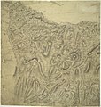
 Ordnance Survey Drawings - Llandovery, Carmarthenshire (OSD 189).jpg 2,352 × 4,000; 3.36 MB
-
 002osd000000010u00136000.jpg 2,015 × 4,000; 4.05 MB
-
 002osd000000010u00137000.jpg 2,146 × 4,000; 3.94 MB
-
 002osd000000003u00149000.jpg 3,804 × 4,000; 5.47 MB
-
 Ordnance Survey Drawings - Llanon, Pembrokeshire (Sir Benfro) (OSD 188).jpg 2,557 × 4,000; 3.69 MB
-
 Ordnance Survey Drawings - Llandovery, Carmarthenshire (Sir Gaerfyrddin) (OSD 190).jpg 5,827 × 3,287; 2.44 MB
-
 002osd000000014u00296000.jpg 4,798 × 4,188; 2.75 MB
-
 LEWIS(1833) p1.181 CARMARTHENSHIRE.jpg 2,887 × 2,285; 3.24 MB
-

-
 PRYSE(1873) p01.617 - Carmarthenshire.jpg 2,944 × 2,354; 1.33 MB
-

-
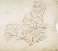
 Carmarthenshire boundaries map 1885.jpg 3,786 × 3,144; 1.39 MB
-
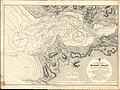 Admiralty Chart No 1167 Burry Inlet, Published 1887.jpg 16,334 × 12,186; 84.83 MB
-
 Admiralty Chart No 1076 St Govens Head to The Mumbles, Published 1888.jpg 19,307 × 10,770; 76.23 MB
_(OSD_187).jpg)
.jpg)


_(OSD_188).jpg)
_(OSD_190).jpg)

_p1.181_CARMARTHENSHIRE.jpg)
.jpg)
_p01.617_-_Carmarthenshire.jpg)
%27_(11128699543).jpg)


