Category:19th-century celestial maps
Jump to navigation
Jump to search
Subcategories
This category has the following 5 subcategories, out of 5 total.
Media in category "19th-century celestial maps"
The following 70 files are in this category, out of 70 total.
-
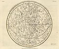
Alexander Jamieson -- Andromeda, Perseus & Caput Medusae.jpg 6,080 × 4,953; 5.12 MB
-
Alexander Jamieson Celestial Atlas-Plate 1.jpg 2,750 × 2,292; 762 KB
-
1830 celestial map depicting Aries, Pegasus, Aquarius by the SDUK.jpg 7,676 × 8,036; 7 MB
-
1830 celestial maps by SDUK depicting several constellations.jpg 14,931 × 7,620; 21.38 MB
-
Globe céleste - par Pierre Tardieu - btv1b8491288w.jpg 9,780 × 7,606; 9.96 MB
-
1840 celestial map of the Northern Hemisphere by Adolf Stieler.jpg 9,385 × 7,801; 13.53 MB
-
... céleste ... - btv1b84913620.jpg 6,357 × 6,368; 6.31 MB
-
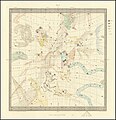
Ca. 1870 celestial map of the Northern Sky.jpg 10,501 × 8,392; 24.23 MB
-
Planisphere Celeste - Hauteur Des Principales Montagnes.jpg 10,920 × 7,567; 13.17 MB
-
Der Nördliche Stern.Himmel.jpg 10,714 × 8,923; 15.71 MB
-
Der Südliche Stern.Himmel and Der Nördliche Stern.Himmel.jpg 10,714 × 17,828; 31.32 MB
-
Der Südliche Stern.Himmel.jpg 10,714 × 8,916; 15.62 MB
-
Ca. 1876 celestial map - Mappemonde Celeste en Deux Hemispheres.jpg 33,783 × 22,031; 101.93 MB
-
1876 French celestial map game board - Jeu des constellations ou voyage dans les regions celestes.jpg 15,251 × 11,968; 31.45 MB
-
A & C Black 1854 Celestial Hemispheres.jpg 4,000 × 2,404; 1.38 MB
-
Astronomical Diagrams RMG L1073-005.tiff 4,030 × 4,800; 55.34 MB
-
Bilder-karte-des-sonnensystems-mit-planeten-und-kometen-bahnen.jpg 1,293 × 1,031; 119 KB
-
Celestial map, 1813 - National Museum of Nature and Science, Tokyo - DSC07416.JPG 4,530 × 3,447; 4.66 MB
-
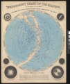
Chart North and South Pole Star Map 01.jpg 794 × 809; 252 KB
-
Chart North and South Pole Star Map 02.jpg 2,341 × 3,000; 2.42 MB
-
Chart North and South Pole Star Map 03.jpg 2,252 × 3,000; 2.4 MB
-
Chart North and South Pole Star Map 04.jpg 2,631 × 2,872; 2.9 MB
-
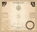
Das Sonnensystem.jpg 1,356 × 1,056; 219 KB
-
Die Südliche Halbkugel für die Zeit der alten Griechen und Römer entworfen.jpg 5,682 × 4,608; 3.58 MB
-
Gebiet der Sonne.jpg 1,368 × 1,155; 223 KB
-
Geography; two rotating discs showing the hemispheres of the Wellcome V0025026.jpg 3,180 × 2,320; 4.22 MB
-
Iconographic Encyclopedia of Science, Literature and Art 013.jpg 1,811 × 1,425; 363 KB
-
Iconographic Encyclopedia of Science, Literature and Art 014.jpg 1,811 × 1,417; 483 KB
-
Iconographic Encyclopedia of Science, Literature and Art 019.jpg 2,839 × 2,317; 840 KB
-
Iconographic Encyclopedia of Science, Literature and Art 020.jpg 1,798 × 1,456; 411 KB
-
Image taken from page 443 of '(School Geography.)' (11051183125).jpg 926 × 512; 102 KB
-
Indicateur céleste Maupérin - btv1b84915099 (1 of 2).jpg 9,052 × 7,266; 5.88 MB
-
Indicateur céleste Maupérin - btv1b84915099 (2 of 2).jpg 9,103 × 7,327; 7.07 MB
-
Karte "Das Sonnensystem".jpg 1,359 × 1,178; 174 KB
-
Lowell - Mars (1894) - page 38.jpg 1,496 × 1,452; 350 KB
-
Map of northern sky, Otto's Encyclopedia.jpg 2,518 × 2,502; 1.38 MB
-
Map of southern sky, Otto's Encyclopedia.jpg 2,574 × 2,502; 1.34 MB
-
Meyers b13 s0105a.jpg 2,048 × 1,611; 433 KB
-
Meyers b6 s0320a.jpg 3,202 × 2,581; 2.37 MB
-
Meyer‘s Zeitungsatlas 064 – Das System unserer Sonne.jpg 7,379 × 6,265; 10.59 MB
-
Monoceros, Canis Minor, Atelier Typographique 3g10076u.jpg 3,657 × 2,540; 2.9 MB
-
Nördlicher Sternhimmel. Südlicher Sternhimmel. Das Sonnensystem. Mondkarte.jpg 1,363 × 1,017; 243 KB
-
Sonnensystem Planeten planetarische Karte.jpg 1,880 × 1,493; 331 KB
-
Sonnensystem Planetenbahnen Planeten Astronomie Lithographie 1889 antiker Druck.jpg 1,290 × 1,025; 140 KB
-
Sonnensystem Sternzeichen, alte planetarische Karte.jpg 1,849 × 1,469; 269 KB
-
Stahlstich- Karte v. Zipter b. B.I.jpg 1,848 × 1,500; 404 KB
-
STARS and CONSTELLATIONS Chart North and South Pole Star Map.jpg 1,234 × 1,239; 401 KB
-
Two 1830 celestial maps by SDUK depicting several constellations.jpg 14,412 × 7,905; 19.23 MB


