Category:1985 maps of the United States
Jump to navigation
Jump to search
States of the United States: Alabama · Florida · Georgia · Louisiana · Massachusetts · New Jersey · New York · Ohio · Virginia
Subcategories
This category has the following 10 subcategories, out of 10 total.
A
- 1985 maps of Alabama (4 F)
F
- 1985 maps of Florida (1 F)
G
L
- 1985 maps of Louisiana (12 F)
M
- 1985 maps of Massachusetts (5 F)
N
- 1985 maps of New Jersey (10 F)
O
- 1985 maps of Ohio (4 F)
V
- 1985 maps of Virginia (1 F)
Media in category "1985 maps of the United States"
The following 4 files are in this category, out of 4 total.
-
 Cape May County, New Jersey LOC 87694229.jpg 6,172 × 7,741; 5.84 MB
-
 Draft Clear Creek management plan and environmental assessment (1985) (20996108115).jpg 3,760 × 2,600; 2.12 MB
-
 Tornado Outbreak 1985-05-31 map.png 2,190 × 2,033; 201 KB
-
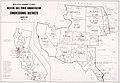 United States Western Area Power Administration congressional districts map 1985.jpg 2,928 × 2,026; 595 KB


_(20996108115).jpg)