Category:1981 maps of Alabama
Jump to navigation
Jump to search
States of the United States: Alabama · Arkansas · California · Connecticut · Delaware · Florida · Georgia · Kentucky · Massachusetts · New York · Ohio · Pennsylvania · South Carolina · Tennessee · Virginia
| 1980 1981 1985 → |
Media in category "1981 maps of Alabama"
The following 14 files are in this category, out of 14 total.
-
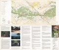
Pinhoti Trail map, Talladega National Forest, Alabama LOC 90684495.jpg 7,839 × 6,670; 8.37 MB
-
Pinhoti Trail map, Talladega National Forest, Alabama LOC 90684495.tif 7,839 × 6,670; 149.59 MB
-
Sipsey Wilderness, William B. Bankhead National Forest LOC 85696073.jpg 15,681 × 6,363; 18.13 MB
-
Sipsey Wilderness, William B. Bankhead National Forest LOC 85696073.tif 15,681 × 6,363; 285.47 MB


