Category:1978 maps of North Carolina
Jump to navigation
Jump to search
States of the United States: Connecticut · Florida · Georgia · Maryland · New Jersey · New Mexico · North Carolina · Ohio · Pennsylvania · South Carolina · Texas · West Virginia – Washington, D.C.
| 1971 1975 1977 1978 1979 → |
Media in category "1978 maps of North Carolina"
The following 16 files are in this category, out of 16 total.
-
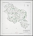
 Cape Hatteras LOC 78696036.jpg 5,338 × 7,138; 7.12 MB
-
 Cape Hatteras LOC 78696036.tif 5,338 × 7,138; 109.01 MB
-
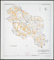
 Hamlet, North Carolina LOC 2005630302.jpg 6,685 × 9,031; 9.28 MB
-
 Hamlet, North Carolina LOC 2005630302.tif 6,685 × 9,031; 172.73 MB
-

-

-

-

-

-

-
-
-
-

-
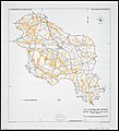
 Raeford, North Carolina LOC 2005630301.jpg 6,553 × 8,140; 8.53 MB
-
 Raeford, North Carolina LOC 2005630301.tif 6,553 × 8,140; 152.61 MB


