Category:1967 maps of Washington, D.C.
Jump to navigation
Jump to search
Media in category "1967 maps of Washington, D.C."
The following 8 files are in this category, out of 8 total.
-
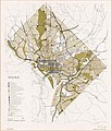
General land use-1967-1985 objectives - (District of Columbia). LOC 2018587339.jpg 5,003 × 5,829; 4.05 MB
-
General land use-1967-1985 objectives - (District of Columbia). LOC 2018587339.tif 5,003 × 5,829; 83.43 MB
-
Proposed Regional WMATA Transit System, 1967.jpg 1,500 × 1,110; 344 KB
-
WMATA's proposal from 1967.jpg 1,165 × 881; 146 KB


