Category:1961 maps of Europe
Jump to navigation
Jump to search
Temperate regions: North America · South America · Africa · Europe · Asia · Oceania – Polar regions: – Other regions:
English: 1961 maps of Europe
Español: Mapas de Europa en 1961
Suomi: Euroopan kartat vuodelta 1961
Română: Hărți ale Europei din 1961
Subcategories
This category has the following 10 subcategories, out of 10 total.
A
- 1961 maps of Austria (2 F)
B
- 1961 maps of Belarus (2 F)
F
- 1961 maps of France (1 F)
G
I
- 1961 maps of Italy (3 F)
N
- 1961 maps of Norway (21 F)
R
- 1961 maps of Russia (4 F)
S
- 1961 maps of Sweden (2 F)
- 1961 maps of Switzerland (12 F)
U
- 1961 maps of Ukraine (1 F)
Media in category "1961 maps of Europe"
The following 14 files are in this category, out of 14 total.
-
 Brcko - Etnicki sastav po naseljima 1961.gif 3,700 × 2,592; 278 KB
-
 British Isles- Terrain and transportation. 4-61. LOC 75693763.tif 6,645 × 8,645; 164.35 MB
-
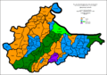
 Croatia-Ethnic-1961.png 1,000 × 990; 510 KB
-
 Istria-Croats-1961.gif 640 × 786; 78 KB
-
 Istria-Ethnic-1961.gif 640 × 786; 91 KB
-
 Istria-Serbs-1961.gif 640 × 786; 86 KB
-
 Istria-Slovenians-1961.gif 640 × 786; 89 KB
-
 Sarajevo - Etnicki sastav po naseljima 1961.gif 2,806 × 3,252; 251 KB
-
 Sarajevo - Udeo Srba po naseljima 1961.gif 2,806 × 3,252; 265 KB
-
 Route of the 1961 Tour de France.png 3,198 × 3,204; 2.63 MB
-
 Tour de France 1961 map.svg 600 × 600; 374 KB
-
 US Army official history map of the Battle for Brest.jpg 1,024 × 920; 355 KB
-
 World outline map - Europe and Africa.jpg 2,004 × 3,915; 1.05 MB
-
 World outline map 1-19,000,000 (approximate) LOC map66000375.tif 8,016 × 15,659; 359.12 MB


