Category:1950 maps of the world
Jump to navigation
Jump to search
Media in category "1950 maps of the world"
The following 16 files are in this category, out of 16 total.
-
 1900 - Britannia's World.jpg 1,095 × 1,152; 320 KB
-
 1950 International Trade (30583518780).jpg 1,366 × 876; 501 KB
-

-
-
 Do more people live in urban or rural areas., OWID.svg 850 × 600; 139 KB
-

-
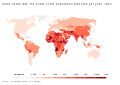
 Life expectancy in 1800, 1950, and 2015.png 3,000 × 4,323; 1.33 MB
-
 Mean years of schooling, OWID.svg 850 × 600; 140 KB
-
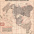 North polar Azimuthal equidistant map, 1950.jpg 2,117 × 2,102; 852 KB
-

-
 The commonwealth of nations, 1950.jpg 3,590 × 2,235; 2.3 MB
-
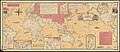
 The first 25 million miles.jpg 1,095 × 1,550; 200 KB
-
 The World - DPLA - 8e439e5657b1e933f180f57f31bb0ea4.jpg 11,963 × 7,141; 8.36 MB
-
 Two Worlds.jpg 7,477 × 5,059; 14.93 MB
-
 World freedom - a factual & pictorial map.tif 12,957 × 5,638; 209.03 MB
-
 World Freedom map by Ernest Dudley Chase 1950.jpg 2,000 × 870; 1.84 MB

.jpg)


.jpg)