Category:1949 maps of Africa
Jump to navigation
Jump to search
Temperate regions: North America · South America · Africa · Europe · Asia · Oceania – Polar regions: – Other regions:
| ← 1940 1941 1942 1943 1944 1945 1946 1947 1948 1949 → |
Subcategories
This category has the following 2 subcategories, out of 2 total.
E
- 1949 maps of Egypt (4 F)
L
- 1949 maps of Libya (5 F)
Media in category "1949 maps of Africa"
The following 7 files are in this category, out of 7 total.
-
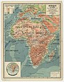 Afrique physique. Cours d'eau, relief du sol - par J. Forest... - btv1b53197054j.jpg 12,265 × 15,808; 32.19 MB
-
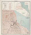 Eritrea. LOC 2001625278.jpg 7,184 × 8,094; 7.27 MB
-
 Eritrea. LOC 2001625278.tif 7,184 × 8,094; 166.36 MB
-

-
 French West Africa - DPLA - 53944da3422ceec80ca02617ad7fb2e0.jpg 4,536 × 3,314; 1.83 MB
-
 The Anglo-Egyptian Sudan LOC 2019589297.jpg 6,661 × 9,739; 11.28 MB
-
 The Anglo-Egyptian Sudan LOC 2019589297.tif 6,661 × 9,739; 185.6 MB


