Category:1942 maps of Washington, D.C.
Jump to navigation
Jump to search
States of the United States: Louisiana · Michigan · Pennsylvania · Utah · Virginia – Washington, D.C.
Puerto Rico
Puerto Rico
| 1941 1942 1945 1946 |
Media in category "1942 maps of Washington, D.C."
The following 4 files are in this category, out of 4 total.
-
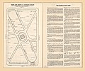
Esso pictorial guide to Washington, D.C., and vicinity - 1942. LOC 87693375.jpg 6,853 × 7,376; 9.09 MB
-
Esso pictorial guide to Washington, D.C., and vicinity - 1942. LOC 87693375.tif 6,853 × 7,376; 144.62 MB
-
Trees and shrubs of Farragut Square - (Washington D.C.) LOC 88690810.jpg 6,334 × 5,273; 4.2 MB
-
Trees and shrubs of Lafayette Square - (Washington D.C.). LOC 88690877.jpg 6,023 × 8,648; 7.62 MB


