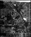
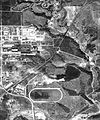
Category:1942 aerial photographs of Toronto
Jump to navigation
Jump to search
Media in category "1942 aerial photographs of Toronto"
The following 18 files are in this category, out of 18 total.
-
Aerial photo of Black Creek, near Mount Dennis, 1942.png 910 × 1,080; 1.16 MB
-
Aerial view of old city hall Toronto.jpg 720 × 547; 180 KB
-
CabbagetownAerial1942.jpg 3,579 × 6,190; 2.26 MB
-
LeasideEastYorkRiverdaleDonValleyThorncliffe.jpg 1,038 × 1,356; 559 KB
-
MimicoAerial1942.png 2,564 × 4,569; 11.96 MB
-
TorontoBabyPointAerial.jpg 6,780 × 6,995; 5.03 MB
-
TorontoColemanAerial1942.jpg 6,948 × 7,746; 11.79 MB
-
TorontoCorktownAerial1942.jpg 7,570 × 1,368; 2.3 MB
-
TorontoEastYorkAerial1942.jpg 6,858 × 7,904; 11.09 MB
-
TorontoGardenDistrictAerial1942.jpg 4,277 × 3,407; 1.54 MB
-
TorontoLeasideAerial1942.jpg 4,111 × 8,301; 3.41 MB
-
TorontoLeslievilleAerial1942.jpg 6,466 × 4,751; 3.51 MB
-
TorontoRiverdaleAerial1942.jpg 5,547 × 6,699; 3.99 MB
-
TorontoRosedaleAerial1942.jpg 6,295 × 7,014; 4.45 MB
-
TorontoStJamestownAerial1942.jpg 4,277 × 3,581; 1.65 MB
-
TorontoThorncliffeAerial1942.jpg 6,223 × 7,495; 4.82 MB
-
TorontoTodmordenAerial1942.jpg 7,344 × 7,692; 10.43 MB
-
TorontoWestonAerial1942.jpg 6,662 × 5,106; 3.45 MB


