Category:1940s maps of the Soviet Union
Jump to navigation
Jump to search
Subcategories
This category has the following 4 subcategories, out of 4 total.
'
L
U
Media in category "1940s maps of the Soviet Union"
The following 59 files are in this category, out of 59 total.
-
26 Азия. Политическая карта.jpg 2,743 × 3,395; 2.52 MB
-
Ethnic map USSR 1941.jpg 3,560 × 2,194; 3.84 MB
-
The growth of the Russian bear.jpg 2,235 × 1,553; 836 KB
-
1940 German military map - Übersichtskarte Charkow-Batum.jpg 24,662 × 32,395; 123.02 MB
-
1941 German military map - Mil.-Geo.-Plan von Leningrad.jpg 19,769 × 24,398; 68.1 MB
-
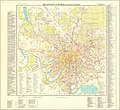
1941 German military map - Mil.-Geo.-Plan von Moskau I (Gesamtes Stadtgebiet).jpg 25,602 × 23,564; 96.34 MB
-
1941 German military map - Straßenkarte von Rußland West-Sibirien.jpg 28,273 × 40,051; 197.87 MB
-
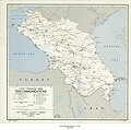
1942 German military map - Rußland (Kaukasus) - K37-IV.jpg 14,836 × 13,726; 31.64 MB
-
1943 German military map - Deutsche Heereskarte Ost-Europa - Zusammendruck Nr. 2.jpg 25,924 × 39,992; 232.59 MB
-
1943 map of the Railroads of U.S.S.R.jpg 3,265 × 2,152; 1.02 MB
-
Russie occidentale économique illustrée - btv1b531211804.jpg 6,624 × 9,116; 9.84 MB
-
Communist Contagion (cropped).jpg 2,879 × 1,179; 1.33 MB
-
Communist Contagion.jpg 3,244 × 4,425; 3.5 MB
-
"Gulag" - Slavery, Inc.jpg 8,957 × 7,064; 14.96 MB
-
Byelorussian SSR Oblasts (1939-1941).png 3,300 × 2,660; 2.22 MB
-
Central and Eastern Siberia - DPLA - 34d38984bdeb3a1776ed349595af62ce.jpg 12,018 × 8,146; 8.42 MB
-
Central and Eastern Siberia - DPLA - 4549b096fc221ed075833197eb85b5bb.jpg 11,935 × 8,035; 6.62 MB
-
Central and Eastern Siberia - DPLA - 98d32c47dac90d16e64c8065396a5f61.jpg 11,950 × 8,211; 6.05 MB
-
Central and Eastern Siberia - DPLA - bae9683659556c1ae945041a96aeb1ec.jpg 11,980 × 8,253; 6.84 MB
-
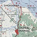
Dolinsk - Starodubskoye railway map (1947).jpg 373 × 373; 54 KB
-
Economic Regions, (USSR)- Southern Region - DPLA - 54a2b176ac085df0c28774437eb8df3a.jpg 12,030 × 8,211; 7.69 MB
-
European U.S.S.R. administrative divisions - July 1, 1946 LOC 2014585445.jpg 5,259 × 6,556; 4.11 MB
-
Finland-map-pravda-1940-03-13-N72.png 1,762 × 2,845; 315 KB
-
Kombinirovannai︠a︡ s"emka Zheldorproekta i SPIĖ Arktikproekta. LOC 2018685888.jpg 3,504 × 2,226; 2.04 MB
-
Kombinirovannai︠a︡ s"emka Zheldorproekta i SPIĖ Arktikproekta. LOC 2018685888.tif 3,504 × 2,226; 22.32 MB
-
Leningrad plan 1940.jpg 4,800 × 6,400; 7.34 MB
-
Map of Japanese Empire August 1942 - DPLA - 0a5010ede7fcba8bd85ef9771b44d17b.jpg 7,866 × 6,364; 9.53 MB
-
Molotov plan 1947.png 596 × 219; 9 KB
-
Mongolia - DPLA - 674cf7730c04f7cdf425024d7cb9df91.jpg 4,360 × 3,323; 1.62 MB
-
U.S. S.R. - Ethnic Compositions - DPLA - 754227d4ec980a6b169104b656de499a.jpg 9,226 × 6,397; 8.72 MB
-
Union of Socialist Republics - DPLA - d04955c04489c018d432fb388e9545a1 (page 1).jpg 15,216 × 11,155; 21.19 MB
-
Union of Socialist Republics - DPLA - d04955c04489c018d432fb388e9545a1 (page 2).jpg 14,979 × 11,159; 21.47 MB
-
Union of Soviet Socialist Republics (USSR) - DPLA - 22b0d2ee5c984c252ebab646df0bbf7f.jpg 5,271 × 4,047; 2.58 MB
-
Union of Soviet Socialist Republics (USSR) - DPLA - 6ca05c5cf1a4decca87a271c2917d6c8.jpg 5,280 × 4,056; 2.37 MB
-
Union of Soviet Socialist Republics (USSR) - DPLA - ed57f7419241e7ddb374f3c262adb321.jpg 11,980 × 7,904; 5.43 MB
-
USSR, 1941.jpg 5,710 × 3,602; 7.13 MB


