Category:1940s maps of London
Jump to navigation
Jump to search
Media in category "1940s maps of London"
The following 17 files are in this category, out of 17 total.
-
Map of the density of bombing, London region, to October 1941 (HO193-45) (29282975318).jpg 4,500 × 4,107; 2.16 MB
-
Air Raid Damage Map - East Marylebone.jpg 1,783 × 2,229; 2.08 MB
-
NorthbrookPark1944OSmap.jpg 783 × 847; 227 KB
-
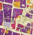
City of London Bomb Damage Map Wood Street and Milk Street.jpg 550 × 587; 368 KB
-
Noble Street and surrounding area Bombing, mapped in 1945.png 2,038 × 1,739; 7.09 MB
-
Proposed inner ring road for London shown in 1945.png 624 × 473; 259 KB
-
Built up bit from london NW OS map 1944.jpg 4,880 × 5,760; 4.45 MB
-
City of London Bomb Damage Map.jpg 1,988 × 2,780; 2.74 MB
-
Heathrow 1948.jpg 525 × 370; 145 KB
-
LondonSE map 1946 nw courner.jpg 7,014 × 5,088; 5.57 MB
-
Londonsw ne courner.jpg 5,024 × 6,992; 5.75 MB
-
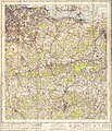
Ordnance Survey One-Inch Sheet 160 London NW, Published 1945.jpg 10,896 × 12,793; 18.93 MB
-
Ordnance Survey One-Inch Sheet 161 London NE, Published 1940.jpg 11,021 × 12,814; 17.22 MB
-
Ordnance Survey One-Inch Sheet 170 London SW, Published 1945.jpg 8,187 × 9,560; 13.79 MB
-
Ordnance Survey One-Inch Sheet 171 London SE, Published 1940.jpg 8,238 × 9,581; 13.91 MB
-
Verkehrsplan von London - btv1b532630159.jpg 8,994 × 11,222; 18.59 MB
-
Wimbledon common 1944.jpg 626 × 811; 515 KB


