Category:1930s maps of Argentina
Jump to navigation
Jump to search
Media in category "1930s maps of Argentina"
The following 4 files are in this category, out of 4 total.
-
 Mapa astra.jpg 700 × 560; 71 KB
-
 Admiralty Chart No 3064 Rio de la Plata Punta Coronilla to Cabo San Antonio, Published 1939.jpg 17,664 × 11,274; 43.27 MB
-
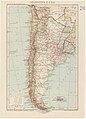 Map Argentina and Chile 1937 - Touring Club Italiano CART-TRC-18.jpg 5,390 × 7,479; 4.81 MB
-
 Mapa escolar de la provincia de San Luis construido - por Pedro Cantal... - btv1b53066600d.jpg 12,289 × 15,922; 20.7 MB


