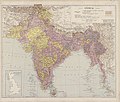
Category:1930 maps of India
Jump to navigation
Jump to search
English: 1930 maps made in India or from India or showing history of India
Media in category "1930 maps of India"
The following 4 files are in this category, out of 4 total.
-
Chandernagor et Bengale 1930.jpg 1,459 × 1,095; 536 KB
-
India - btv1b8460263x.jpg 9,834 × 8,340; 13.28 MB
-
Map of India, 1930.jpg 2,250 × 2,591; 791 KB
-
Near East & India 1930, svatlas.jpg 2,289 × 1,700; 1.93 MB


