Category:1929 maps of Asia
Jump to navigation
Jump to search
Temperate regions: North America · South America · Africa · Europe · Asia · – Polar regions: – Other regions:
English: 1929 maps of Asia
Español: Mapas de Asia en 1929
Subcategories
This category has the following 3 subcategories, out of 3 total.
Media in category "1929 maps of Asia"
The following 7 files are in this category, out of 7 total.
-
 Asia mapa político - por J. Forest... - btv1b530652512.jpg 15,684 × 12,342; 31.02 MB
-
 Asia politica - por J. Forest... - btv1b53066535h.jpg 15,590 × 12,267; 34.12 MB
-
 Asie politique - par J. Forest - btv1b530665488.jpg 15,857 × 12,519; 34.01 MB
-
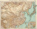 Dominio Cinese, Ta Chung Hua Min Kuo, e Impero Giapponese, Dai Nihon.jpg 7,976 × 6,377; 13 MB
-

-
 Map Arabia 1929 - Touring Club Italiano CART-TRC-10.jpg 4,605 × 6,198; 19.7 MB
-
 원산(1929)(10000-1).jpg 2,695 × 2,500; 3.33 MB


(10000-1).jpg)