Category:1926 maps of Hawaii
Jump to navigation
Jump to search
States of the United States: Georgia · Hawaii · Illinois · Michigan · North Dakota · Pennsylvania · Texas · Wisconsin
Media in category "1926 maps of Hawaii"
The following 5 files are in this category, out of 5 total.
-
Kahoolawe, Hawaii LOC 2005625311.jpg 7,914 × 6,064; 7.01 MB
-
Kahoolawe, Hawaii LOC 2005625311.tif 7,914 × 6,064; 137.3 MB
-
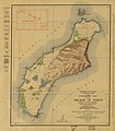
Niihau 1926 USGS map.jpg 5,560 × 6,377; 3.97 MB
-
Topographic map of the Island of Niihau, Kauai County, Hawaii LOC 2005625309.jpg 5,560 × 6,377; 4.84 MB
-
Topographic map of the Island of Niihau, Kauai County, Hawaii LOC 2005625309.tif 5,560 × 6,377; 101.44 MB


