Category:1922 maps of Ukraine
Jump to navigation
Jump to search
Media in category "1922 maps of Ukraine"
The following 16 files are in this category, out of 16 total.
-
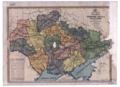 Administrative map of the Ukrainian Socialist Soviet Republic, 1922.png 2,000 × 1,445; 1.72 MB
-
 Europe of to-day (1922) (14802414573).jpg 1,774 × 2,390; 628 KB
-
 Small map Korostowa.jpg 797 × 725; 255 KB
-
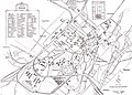 Stryi Map 1922.jpg 2,021 × 1,453; 1.02 MB
-
 Волинська губернія 1922.jpg 950 × 950; 852 KB
-
 Донецька губернія 1922 рік.jpg 1,316 × 1,316; 1.47 MB
-
 Запорізька губернія 1922.jpg 1,086 × 1,086; 1.28 MB
-
 Карта УССР, 1922 год.jpg 700 × 476; 53 KB
-
 Катеринославська губернія 1922.jpg 1,312 × 1,396; 1.8 MB
-
 Київська губернія 1922.jpg 1,296 × 1,296; 1.8 MB
-
 Кременчуцька губернія 1922.jpg 782 × 782; 717 KB
-
 Одеська та Миколаївська губернії 1922.jpg 1,456 × 1,456; 1.93 MB
-
 Подільська губернія 1922.jpg 1,085 × 1,085; 1.13 MB
-
 Полтавська губернія 1922.jpg 1,238 × 1,238; 1.7 MB
-
 Харківська губернія 1922.jpg 1,341 × 1,341; 1.58 MB
-
 Чернігівська губернія 1922.jpg 1,084 × 1,084; 1.21 MB

_(14802414573).jpg)


