Category:1920s maps of Morocco
Jump to navigation
Jump to search
Countries of Africa: Algeria · Angola · Democratic Republic of the Congo · Djibouti · Egypt‡ · Ethiopia · Madagascar · Mauritania · Morocco · Nigeria · South Africa · Sudan · Tunisia
‡: partly located in Africa
‡: partly located in Africa
Subcategories
This category has the following 8 subcategories, out of 8 total.
- 1920 maps of Morocco (2 F)
- 1921 maps of Morocco (4 F)
- 1922 maps of Morocco (4 F)
- 1923 maps of Morocco (3 F)
- 1924 maps of Morocco (2 F)
- 1925 maps of Morocco (2 F)
- 1928 maps of Morocco (2 F)
- 1929 maps of Morocco (1 F)
Media in category "1920s maps of Morocco"
The following 13 files are in this category, out of 13 total.
-
1920 map of Spanish Morocco.jpg 11,634 × 8,165; 16.82 MB
-
Nouvelle carte du Maroc, commerce, industrie, tourisme - btv1b532099383.jpg 11,319 × 9,825; 22.96 MB
-
Plan de Marrakech - btv1b8446414f.jpg 6,838 × 6,180; 5.41 MB
-
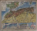
Afrique du Nord - par Paul Castelnau... - btv1b525059404 (1 of 2).jpg 19,228 × 16,428; 43.68 MB
-
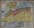
Afrique du Nord - par Paul Castelnau... - btv1b525059404 (2 of 2).jpg 19,328 × 16,085; 42.61 MB
-
Maroc au - 1-1.500.000 - btv1b53100098s (1 of 2).jpg 8,098 × 6,521; 7.9 MB
-
Maroc au - 1-1.500.000 - btv1b53100098s (2 of 2).jpg 8,091 × 6,494; 7.44 MB
-
Pacification of Morocco (1907-1927) - Pacfication du maroc (1907-1927).jpg 1,441 × 1,054; 344 KB
-
Admiralty Chart No 1238 Cape Roca to Cape Blanco, Published 1929.jpg 11,067 × 16,202; 53.5 MB
-
خريطة اقتصادية للمغرب 1928.jpg 7,920 × 6,712; 8.06 MB
-
خريطة السكك الحديدية في المغرب 1924.jpg 4,115 × 2,948; 862 KB
-
خريطة عسكرية وإدارية للمغرب 1921.jpg 8,075 × 6,641; 7.89 MB
-
خريطة لمراحل احتلال المغرب 1920.jpg 8,446 × 6,834; 8.77 MB


