Category:1918 maps of France
Jump to navigation
Jump to search
Media in category "1918 maps of France"
The following 9 files are in this category, out of 9 total.
-
AEF Stations France 1918.jpg 1,500 × 1,640; 341 KB
-
Coudun 1918.jpg 1,489 × 2,106; 1.26 MB
-
Coudun juin 1918.jpg 715 × 1,081; 345 KB
-
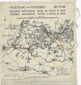
Disposition of Medical Units in the Chateau-Thierry Sector - NARA - 6997190 (page 1).jpg 2,400 × 2,529; 667 KB
-
Disposition of Medical Units in the Chateau-Thierry Sector - NARA - 6997190 (page 2).pdf 1,200 × 1,262; 676 KB
-
Maissemy, WW1 map.tif 13,569 × 11,787; 457.65 MB
-
Map of the Boundary of Eastern France - NARA - 596202.jpg 690 × 1,200; 205 KB


