Category:1914 maps of Lithuania
Jump to navigation
Jump to search
Media in category "1914 maps of Lithuania"
The following 12 files are in this category, out of 12 total.
-
 02-Westliches Russland (1914).png 9,917 × 11,373; 178.87 MB
-
 03-Deutsch-Französisch-Russische Kriegskarte (1914).png 12,092 × 9,917; 197.44 MB
-
 AtHistEur1914.jpg 1,301 × 1,440; 192 KB
-
 BalticGovernorates1914.png 3,012 × 2,980; 925 KB
-
 CongressPoland1914MapRUS.png 2,125 × 2,524; 1.19 MB
-
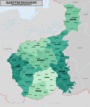
 CourlandGovernorate1914.png 1,262 × 837; 190 KB
-
 Europe (14961913325).jpg 1,635 × 2,000; 3.47 MB
-
 FronteraPolaca--timeshistoryofwa21londuoft-p408.svg 2,014 × 2,816; 1.98 MB
-
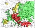 Map 1914 WWI Alliances.jpg 1,682 × 1,328; 615 KB
-

-
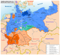 Wahlrecht Deutsches Reich 1914.svg 992 × 917; 2.23 MB
-
 Карта России по губерниям и областям (1914).jpg 6,028 × 3,789; 23.41 MB
.png)
.png)


.jpg)


_(14578499199).jpg)

.jpg)