Category:1912 maps of New York City
Jump to navigation
Jump to search
Subcategories
This category has the following 2 subcategories, out of 2 total.
M
S
Media in category "1912 maps of New York City"
The following 4 files are in this category, out of 4 total.
-
 Claremont Park 1912 Map.jpg 2,468 × 3,165; 3.25 MB
-
 Crotona Park 1912 Map.jpg 2,792 × 3,465; 10.3 MB
-
 Panoramic view of New York City and vicinity. LOC 2010587909.jpg 8,654 × 6,481; 13.57 MB
-
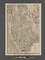 Southern part of the borough of the Bronx, from the Bronx Kills to Kingsbridge (1912).jpg 8,706 × 11,605; 35.16 MB


.jpg)