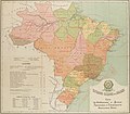
Category:1912 maps of Brazil
Jump to navigation
Jump to search
Countries of the Americas: Brazil · Canada · Mexico · United States of America
Other areas: Dutch Caribbean
Other areas: Dutch Caribbean
Media in category "1912 maps of Brazil"
The following 9 files are in this category, out of 9 total.
-
Brazil. Brazil railway company - btv1b84456513.jpg 7,440 × 9,202; 11.04 MB
-
Carta Geral do Estado de São Paulo (1912) - 1, Acervo do Museu Paulista da USP.jpg 7,216 × 5,412; 22.75 MB
-
Mapa do Paraná em 1912.jpg 933 × 660; 257 KB


