Category:1912 maps
Jump to navigation
Jump to search
| ← · 1910 · 1911 · 1912 · 1913 · 1914 · 1915 · 1916 · 1917 · 1918 · 1919 · → |
Deutsch: Karten mit Bezug zum Jahr 1912
English: Maps related to the year 1912
Español: Mapas relativos al año 1912
Français : Cartes concernant l’an 1912
Русский: Карты 1912 года
Subcategories
This category has the following 11 subcategories, out of 11 total.
Media in category "1912 maps"
The following 135 files are in this category, out of 135 total.
-
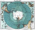
 (Süd-Polar-Karte) LOC 2002624041.jpg 5,676 × 4,763; 4.32 MB
-
 (Süd-Polar-Karte) LOC 2002624041.tif 5,676 × 4,763; 77.35 MB
-
 AntiochMap1912.jpg 1,171 × 798; 344 KB
-
 1912 Blue Hill Street Railway map.png 1,624 × 2,500; 6.55 MB
-
 1912 Boston and Worcester Street Railway track map - left.png 3,866 × 2,500; 9.84 MB
-
 1912 Boston and Worcester Street Railway track map - right.png 3,852 × 2,500; 12.9 MB
-
 1912 Saussine Pictorial Broadside Game Board of a Plane Trip Around the World.png 4,500 × 3,343; 42.92 MB
-
 1kingdom-of-italy1811.png 2,560 × 1,546; 11.34 MB
-
 Abu-Reyhan Biruni (editado por Ernest Rhys 1912) 1030.jpg 2,608 × 1,565; 1.02 MB
-
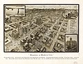
 Aero view of Bristol, Va.=Tenn. 1912. LOC 75696638.jpg 10,704 × 8,448; 22.07 MB
-
 Aero view of Bristol, Va.=Tenn. 1912. LOC 75696638.tif 10,704 × 8,448; 258.72 MB
-
 Aero view of Norwich, Connecticut 1912. LOC 75693159.jpg 12,416 × 9,856; 26.97 MB
-
 Aero view of Norwich, Connecticut 1912. LOC 75693159.tif 12,416 × 9,856; 350.11 MB
-
 Afghanistan. LOC 2004629161.jpg 6,281 × 5,271; 5.12 MB
-
 Afghanistan. LOC 2004629161.tif 6,281 × 5,271; 94.72 MB
-

-
 Antarctica 1912 edit.jpg 4,940 × 4,296; 17.94 MB
-
 Antarctica 1912.jpg 5,676 × 4,763; 17.15 MB
-
 BarrowHighlandBoundaryFault.png 3,039 × 1,880; 6.55 MB
-
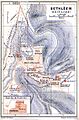 Bethlehem 1912.ink.jpg 782 × 1,190; 468 KB
-
 Birds eye view of New York and vicinity - C.S. Hammond and Co. NYPL1691403.tiff 5,428 × 7,230; 112.28 MB
-
 Black Mountain, N.C. 1912. LOC 75694897.jpg 10,048 × 6,736; 13.32 MB
-
 Black Mountain, N.C. 1912. LOC 75694897.tif 10,048 × 6,736; 193.64 MB
-
 BNA-DIG-WERBATA-004.jpg 5,448 × 5,394; 3.82 MB
-

-
 Brockenbahn Karte 1912.JPG 706 × 475; 95 KB
-
 Cambridge Subway 1912 map with surface connections.jpg 1,014 × 749; 268 KB
-
 Campagnes du contingent du Hesse-Darmstadt sous le premier empire. LOC 98687112.jpg 10,896 × 5,728; 6.96 MB
-
 Campagnes du contingent du Hesse-Darmstadt sous le premier empire. LOC 98687112.tif 10,896 × 5,728; 178.56 MB
-
 Canadian Pacific Railway and connecting lines LOC 2006627697.jpg 9,551 × 5,285; 7.17 MB
-
 Canadian Pacific Railway and connecting lines LOC 2006627697.tif 9,551 × 5,285; 144.42 MB
-
 Caïffa (FL45612594 3958888).jpg 1,991 × 1,797; 1.04 MB
-
 Changes in Turkey-in-Europe 1856 to 1878.png 809 × 1,314; 1.6 MB
-
 Charlestown Navy Yard Mystic Wharf Map 1912.jpg 3,500 × 2,429; 2.87 MB
-
 Chemin de fer et route de Jaffa à Jérusalem (FL45612527 3958698).jpg 2,297 × 1,798; 1.14 MB
-
 City wall of Deqing, Zhejiang in 1912.jpg 2,829 × 1,776; 1.04 MB
-
 Civil War, 1861-1865 LOC 99447218.jpg 8,857 × 5,798; 4.03 MB
-
 Civil War, 1861-1865 LOC 99447218.tif 8,857 × 5,798; 146.92 MB
-
-
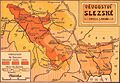 Duchy of Silesia 1912.jpg 2,043 × 1,417; 805 KB
-
 E. Ruze, Jérusalem Les Enceintes (FL45612544 3958704).jpg 1,265 × 1,805; 647 KB
-
 Environs de Bethléem (FL45612598 3958871).jpg 1,734 × 1,214; 1.07 MB
-
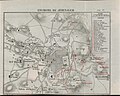 Environs de Jérusalem (FL45612581 3958862).jpg 2,288 × 1,824; 1.24 MB
-
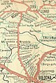
 Ethnographic-map-Thrace-1912.jpg 3,520 × 2,080; 6.01 MB
-
 Ferrovia Bologna-Verona - dettaglio da carta compartimentale 1912.jpg 1,097 × 1,622; 376 KB
-

-

-
 France in 1792.jpg 1,033 × 637; 167 KB
-
 French Empire and Central Europe 1811 Political Divisions.jpg 3,250 × 2,608; 2.57 MB
-
 Genoese world map 1457. LOC 97690053.tif 10,465 × 6,763; 202.49 MB
-
 Geological magazine (1912) (14592958747).jpg 4,560 × 2,096; 1.8 MB
-
 Geological magazine (1912) (14593034237).jpg 2,528 × 1,656; 682 KB
-
 Gradteigsmålinger F34-6 e, F34-6 f, Buskerud, 1912.jpg 6,969 × 7,381; 5.24 MB
-
 Guide to Galway, Connemara and the West of Ireland (1912) (14802203163).jpg 1,748 × 3,670; 1.36 MB
-
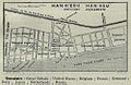 Han keou 1912.jpg 498 × 325; 53 KB
-
 Houston-a modern city. LOC 75696599.jpg 6,744 × 5,248; 9.2 MB
-
 Houston-a modern city. LOC 75696599.tif 6,744 × 5,248; 101.26 MB
-
 Indigenous tribes on the border of Argentina and Bolivia (1912).png 468 × 588; 44 KB
-

-

-

-

-
 International map of the world on the scale 1 1,000,000. (2709987839).jpg 1,200 × 1,144; 451 KB
-
 Jaffa (FL45612518 3958522).jpg 1,153 × 1,775; 982 KB
-
 Jerusalem (FL66281621 4372619).jpg 9,124 × 8,054; 85.55 MB
-
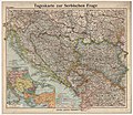
 Jovan Cvijic 1912 Der Zugang Serbiens zur Adria.jpg 2,826 × 3,842; 16.37 MB
-

-
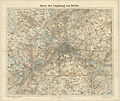 Karte der Umgebung von Berlin 100K 1912.jpg 18,334 × 15,376; 62.29 MB
-
 Kings and gods of Egypt (1912) (14583125749).jpg 2,368 × 2,316; 671 KB
-
 L'esplanade du Temple (FL45612559 3958753).jpg 1,258 × 1,750; 927 KB
-
 Le mont des Oliviers et Béthanie (FL45612573 3958848).jpg 1,775 × 1,265; 1.05 MB
-
 Le Mont Sion Chrétien (FL48326379 3958757).jpg 1,841 × 2,857; 5.31 MB
-
 Lee County, Illinois showing rural delivery service LOC 2008627965.jpg 17,823 × 12,542; 25.67 MB
-
 Lee County, Illinois showing rural delivery service LOC 2008627965.tif 17,823 × 12,542; 639.54 MB
-
 Les chemins du St. Sepulcre (FL45612537 3958741).jpg 1,157 × 1,814; 623 KB
-
 Lexington & Central Ky. Title Co.'s Map of Lexington, Ky. and vicinity LOC 79691619.tif 12,429 × 10,060; 357.73 MB
-

-
 Map of Columbia from an actual survey by Messrs. Arthur and Moore. LOC 77696235.jpg 9,268 × 10,778; 15.65 MB
-
 Map of Columbia from an actual survey by Messrs. Arthur and Moore. LOC 77696235.tif 9,268 × 10,778; 285.79 MB
-
 Map of Harris County - Northeast One-fourth.jpg 598 × 441; 79 KB
-
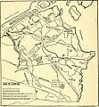
 Map of Hebron (1912).jpg 608 × 942; 579 KB
-
 Map of the District of Columbia showing real estate valuation areas. LOC 87694392.jpg 6,552 × 5,372; 6.71 MB
-
 Map of the District of Columbia showing real estate valuation areas. LOC 87694392.tif 6,552 × 5,372; 100.7 MB
-

-

-
 Map showing the battle field at Harrisburg, Miss. July 13-15, 1864. LOC 99447417.jpg 7,497 × 5,057; 5.27 MB
-
 Map showing the battle field at Harrisburg, Miss. July 13-15, 1864. LOC 99447417.tif 7,497 × 5,057; 108.47 MB
-
 MapaMacau1912.jpg 631 × 908; 81 KB
-
 NORTEAMERICA FISICO.jpg 1,299 × 1,100; 983 KB
-
 Oak View D.C. LOC 88693006.jpg 5,392 × 4,233; 1.51 MB
-
 Oak View D.C. LOC 88693006.tif 5,392 × 4,233; 65.3 MB
-
 Official map of South Carolina LOC 78693410.jpg 9,080 × 7,151; 7.02 MB
-
 Official map of South Carolina LOC 78693410.tif 9,080 × 7,151; 185.77 MB
-
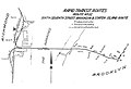
 Old Tracks and Routes in Newtown (Plate LIV, p. 272).jpg 1,052 × 1,628; 236 KB
-
 Old Tracks and Routes in Newtown - Crop.jpg 959 × 1,038; 413 KB
-
 Old Tracks and Routes in Newtown - Map of Bus Routes 01.jpg 959 × 1,038; 436 KB
-
 Old Tracks and Routes in Newtown - Map of Bus Routes 02.jpg 959 × 1,038; 426 KB
-
 Ontario High School History of England (1912) (14756769396).jpg 1,840 × 2,450; 570 KB
-
 OutlineMapLoetschbergbahnSwitzerland.jpg 1,174 × 1,272; 209 KB
-
 Palaeontographica (1912) (14766419152).jpg 4,406 × 2,324; 2.49 MB
-

-
 Palmer's farm map of Brooke County, West Virginia LOC 2012593062.jpg 9,522 × 18,174; 19.14 MB
-
 Panama, the isthmus and the canal (1912) (14741756796).jpg 2,256 × 1,314; 514 KB
-
 Panoramic view of New York City and vicinity. LOC 2010587909.tif 8,654 × 6,481; 160.47 MB
-
 Periplus 079 Berberah.png 1,432 × 1,948; 3.42 MB
-
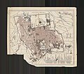
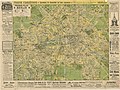 Pharus Plan Berlin 1912.jpg 14,592 × 10,924; 50.26 MB
-
 Plan de Jérusalem (FL45612576 3958865).jpg 3,202 × 3,688; 3.13 MB
-

-
 Reconhecimento hydrográphico (sic) do pôrto e rada de Macau. LOC 89696066.jpg 6,396 × 8,477; 7.45 MB
-
 Reconhecimento hydrográphico (sic) do pôrto e rada de Macau. LOC 89696066.tif 6,396 × 8,477; 155.12 MB
-
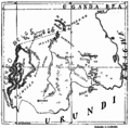 Ruanda Prov 1912 B002a.png 1,845 × 1,818; 946 KB
-
 Rural Delivery Routes; Fairfax County, Va. LOC 2007627499.jpg 9,455 × 10,334; 7.83 MB
-
 Seiches Ammersee.jpg 1,562 × 832; 300 KB
-
 Sheet No. 43. (Includes Wild Avenue, Linoleumville (Travis).) NYPL1531754.tiff 7,230 × 5,428; 112.31 MB
-
 Sheet No. 51 (Includes Island of Meadows, Fresh Kills and Arthur Kill.) NYPL1531762.tiff 7,230 × 5,428; 112.31 MB
-

-
 South African Geology - Schwarz - 1912 Fig 2 Colored.png 1,209 × 806; 82 KB
-
 Spezialkarte der Österreichisch-ungarischen Monarchie - Cilli und Ratschach 1912.jpg 14,753 × 11,366; 35.77 MB
-
 Spezialkarte der Österreichisch-ungarischen Monarchie - Laibach 1912.jpg 12,695 × 9,823; 30.72 MB
-
 Spezialkarte der Österreichisch-ungarischen Monarchie - Radkersburg und Luttenberg 1912.jpg 14,657 × 11,406; 29.94 MB
-
 Spezialkarte der Österreichisch-ungarischen Monarchie - Radmannsdorf 1912.jpg 14,701 × 11,482; 34.21 MB
-
 Spezialkarte der Österreichisch-ungarischen Monarchie - Unt. Drauburg 1912.jpg 14,689 × 11,394; 35.6 MB
-
 Spezialkarte der Österreichisch-ungarischen Monarchie - Weixelburg und Zirknitz 1912.jpg 13,543 × 10,423; 32.5 MB
-
 St. Etienne. Ste Anne Cavernes royales (FL45612562 3958823).jpg 1,694 × 1,120; 690 KB
-
 StatenIslandTunnel.jpg 726 × 496; 71 KB
-

-

-
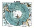 Sud Polar Karte.jpg 5,598 × 4,673; 4.23 MB
-
-
 Terrain Saint - Pierre (FL48326418 3958815).jpg 1,889 × 3,099; 5.52 MB
-

-
 The international industries mining and forest bank (1912) (14597617389).jpg 3,552 × 2,320; 1.46 MB
-
 Topographical sketch of the New Market, Va., battlefield of May 15, 1864, LOC 99448861.tif 4,759 × 6,877; 93.63 MB
-
 ZakamskayaLiniya 1745.jpg 5,190 × 1,622; 1.64 MB
-
 План Луганска 1912.jpg 6,496 × 4,675; 8.01 MB
_LOC_2002624041.jpg)


_1030.jpg)


.jpg)


.jpg)


.jpg)


.jpg)
.jpg)
.jpg)


.jpg)


_(14592958747).jpg)
_(14593034237).jpg)

_(14802203163).jpg)


.png)


.jpg)
.jpg)
.jpg)


_(14583125749).jpg)
.jpg)
.jpg)
.jpg)

.jpg)


.jpg)


.jpg)


_(14756769396).jpg)

_(14766419152).jpg)
_LOC_2009579463.jpg)

_(14741756796).jpg)


.jpg)

_do_p%C3%B4rto_e_rada_de_Macau._LOC_89696066.jpg)


.jpg)


.jpg)
_(14597566037).jpg)
_(14597617389).jpg)

_(19175430298).jpg)