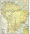
Category:1910s maps of South America
Jump to navigation
Jump to search
Temperate regions: North America · South America · Africa · Europe · Asia · Oceania – Polar regions: – Other regions:
Subcategories
This category has the following 20 subcategories, out of 20 total.
- 1916 maps of South America (15 F)
.
A
B
C
- 1910s maps of Chile (12 F)
E
- 1910s maps of Ecuador (5 F)
P
- 1910s maps of Paraguay (5 F)
- 1910s maps of Peru (7 F)
U
- 1910s maps of Uruguay (10 F)
V
- 1910s maps of Venezuela (10 F)
Media in category "1910s maps of South America"
The following 11 files are in this category, out of 11 total.
-
An atlas of commercial geography (1913) (14594838048).jpg 2,912 × 2,408; 1.62 MB
-
An atlas of commercial geography (1913) (14594839718).jpg 2,540 × 2,890; 1.86 MB
-
An atlas of commercial geography (1913) (14594973257).jpg 2,912 × 2,404; 1.55 MB
-
Annales de la Société entomologique de Belgique (1910) (17582061193).jpg 1,510 × 2,626; 500 KB
-
Annals of the New York Academy of Sciences (1912) (18387712606).jpg 1,726 × 2,592; 767 KB
-
Bulletin of the Geological Society of America (1918) (20450235985).jpg 2,444 × 3,192; 1.64 MB
-
LA2-NSRW-1-0087.jpg 2,781 × 3,766; 2.37 MB
-
New geographies (1910) (14783796465).jpg 1,700 × 2,390; 822 KB
-
The American Museum journal (c1900-(1918)) (18159690515).jpg 1,698 × 1,146; 303 KB
-
The birds of South America (1912) (14726735796).jpg 2,992 × 1,873; 1.53 MB


