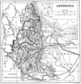
Category:1910s maps of Somalia
Jump to navigation
Jump to search
Media in category "1910s maps of Somalia"
The following 6 files are in this category, out of 6 total.
-
Ethiopia1911.png 2,004 × 2,066; 3.06 MB
-
Somalia1911.png 963 × 976; 847 KB
-
Somaliland (1919).png 7,175 × 9,352; 90.91 MB
-
An old map of Zeila featuring the Somali Gadabuursi Dir clan2.jpg 1,822 × 1,350; 638 KB
-
Territory Of Gaalje'el.jpg 579 × 972; 582 KB


