
Category:1910s maps of Italy
- Regions of Italy: Liguria · Trentino-South Tyrol ·
Subcategories
This category has the following 9 subcategories, out of 9 total.
- 1912 maps of Italy (3 F)
- 1913 maps of Italy (1 F)
- 1914 maps of Italy (1 F)
- 1917 maps of Italy (1 F)
- 1918 maps of Italy (1 F)
.
- 1910s maps of Liguria (5 F)
Media in category "1910s maps of Italy"
The following 15 files are in this category, out of 15 total.
-
 Karta över Italien, 1910, Nordisk familjebok.jpg 2,480 × 3,480; 1.93 MB
-

-

-
 Review of reviews and world's work (1890) (14773479315).jpg 1,824 × 1,860; 382 KB
-
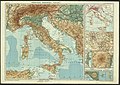
 A history of mediaeval and modern Europe for secondary schools (1914) (14597819338).jpg 3,344 × 1,992; 636 KB
-
 A history of painting (1911) (14760576776).jpg 1,610 × 1,902; 947 KB
-
 A history of painting... - with a preface by Frank Brangwyn (1911) (14781715671).jpg 2,144 × 2,472; 899 KB
-
 Battisti - Il Trentino, cenni geografici, storici, economici, 1915 58.jpg 3,270 × 2,331; 2.42 MB
-
 Battisti - Il Trentino, cenni geografici, storici, economici, 1915 59.jpg 2,456 × 2,833; 2.6 MB
-
 Battisti - Il Trentino, cenni geografici, storici, economici, 1915 60.jpg 3,210 × 2,307; 2.56 MB
-
 Battisti - Il Trentino, cenni geografici, storici, economici, 1915 61.jpg 3,195 × 2,301; 2.44 MB
-
 Fifty years of Europe, 1870-1919 (1919) (14758562826).jpg 1,711 × 3,128; 669 KB
-
 Humoristische Italienkarte - Karikatur - Propagandaplakat.jpg 1,940 × 2,917; 663 KB
-
 Ricordi di Mirko Festaro, item 3.jpg 1,040 × 917; 1.25 MB
-
 Półwysep Apeniński (Włochy) (72769710).jpg 9,886 × 7,024; 14.25 MB

_(14775832631).jpg)

_(14773479315).jpg)
_(14597819338).jpg)
_(14760576776).jpg)
_(14781715671).jpg)


_(14758562826).jpg)


_(72769710).jpg)