Category:1906 maps of Africa
Jump to navigation
Jump to search
Temperate regions: North America · South America · Africa · Europe · Asia · – Polar regions: – Other regions:
| ← 1900 1901 1902 1903 1904 1905 1906 1907 1908 1909 → |
Media in category "1906 maps of Africa"
The following 12 files are in this category, out of 12 total.
-
Angola 1906.jpg 1,600 × 2,585; 597 KB
-
Brockhaus and Efron Jewish Encyclopedia e3 461-0.jpg 921 × 843; 142 KB
-
MandingoMap-1906.jpg 743 × 477; 189 KB
-
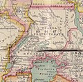
Map of Uganda Protectorate from Harrison and Sons.jpg 827 × 817; 121 KB
-
Outlines of nineteenth century history (1906) (14781629444).jpg 2,018 × 3,112; 1.66 MB
-
Outlines of nineteenth century history (1906) (14783983135).jpg 2,093 × 3,336; 1.81 MB
-
Railway Map of South Africa.jpg 575 × 641; 72 KB
-
The natives of British Central Africa (1906) (14780571234), white background.jpg 2,034 × 1,518; 321 KB
-
Wirtschafts-Atlas der deutschen Kolonien - 14.jpg 2,446 × 3,351; 790 KB
-
Wirtschafts-Atlas der deutschen Kolonien - 18.jpg 2,504 × 3,351; 791 KB


