Category:1905 maps of India
Jump to navigation
Jump to search
English: 1905 maps made in India or from India or showing history of India
Media in category "1905 maps of India"
The following 17 files are in this category, out of 17 total.
-
 D121- Inde primitive -liv2-ch12.png 1,452 × 1,838; 472 KB
-
 D129- Territoire indien, d’après Claude Ptolémée. -liv2-ch12.png 1,439 × 1,034; 178 KB
-
 D131- Contraste des deux Versants. -liv2-ch12.png 1,442 × 1,598; 344 KB
-
 D137- Langages du Dekkan -liv2-ch12.png 1,364 × 1,892; 279 KB
-
 D145- Pays des Cinq Fleuves -liv2-ch12.png 1,460 × 1,888; 618 KB
-
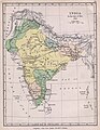
 D160- Provinces de l’Inde -liv2-ch12.png 1,433 × 2,034; 286 KB
-
 D161- Relief de l’Inde -liv2-ch12.png 1,431 × 2,046; 418 KB
-
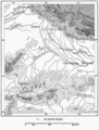 D173- Seuil de l’Hindoustan -liv2-ch12.png 1,428 × 1,876; 385 KB
-
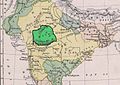
 D189- Inde des origines bouddhiques -liv2-ch12.png 1,448 × 1,420; 368 KB
-
 D209- Capitales de l’Inde -liv2-ch12.png 1,430 × 1,946; 227 KB
-
 D259- Carte des formes de mariages aux Indes. - L1-Ch5.png 1,504 × 1,798; 358 KB
-
 D273- carte du pays de l’honneur et de l’infanticide. - L1-Ch5.png 1,514 × 1,918; 355 KB
-
 D585- N° 415. L’Inde de Dupleix - liv3-ch15.png 1,439 × 1,591; 215 KB
-
 India1760 1905.jpg 1,154 × 1,485; 222 KB
-
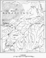
 Malwa Map.jpg 946 × 672; 136 KB
-
 P051 - N° 531. Villes et États de l’Inde. - Liv4-Ch05.png 1,440 × 1,724; 425 KB
-
 P054 - N° 532. Simla et Delhi. - Liv4-Ch05.png 1,446 × 1,692; 221 KB


