Category:1900s maps of Sudan
Jump to navigation
Jump to search
Media in category "1900s maps of Sudan"
The following 11 files are in this category, out of 11 total.
-
Third Salisbury administration, 1895-1900 (1900) (14756916596).jpg 5,528 × 6,316; 2.5 MB
-
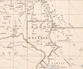
Lado Enclave (The Anglo-Egyptian Sudan (cropped)).png 1,948 × 1,620; 4.99 MB
-
The Anglo-Egyptian Sudan.png 6,894 × 8,558; 88.89 MB
-
088 agypten-dar-fur-und-abessinien (1905).png 1,695 × 2,205; 2.24 MB
-
The Harmsworth atlas and Gazetter 1908 (135850580).jpg 9,572 × 12,531; 123.22 MB
-
Map of the Soudan.png 3,003 × 3,773; 9.53 MB
-
Map of Egypt and the Soudan.png 2,706 × 3,705; 4.49 MB
-
The Anglo-Egyptian Sudan LOC 2013590282.jpg 6,894 × 8,558; 6.57 MB
-
The Anglo-Egyptian Sudan LOC 2013590282.tif 6,894 × 8,558; 168.8 MB
-
Yuzhakov Big Encyclopedia Map of Egypt.jpg 3,828 × 4,620; 3.7 MB


